The highest point within San Diego city limits, Cowles Mountain offers a rugged, expansive panorama stretching from the downtown skyline to the Mexican border.
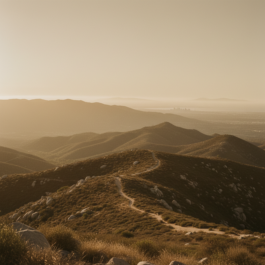
Cowles Mountain rises 1,593 feet above the San Carlos neighborhood, standing as the highest point within the city limits of San Diego. Named for George A. Cowles, a prominent 19th-century rancher whose surname is historically pronounced like "coals", this rugged peak of volcanic rock serves as the crown jewel of Mission Trails Regional Park. The primary route ascends from the bustling trailhead at 7001 Golfcrest Drive, where a dusty path immediately cuts into a dense canopy of coastal sage scrub and chaparral. The air here carries the dry, sweet scent of wild white sage, chamise, and black sage. As hikers ascend the relentless switchbacks, the sounds of suburban traffic fade, replaced by the dry rustle of western fence lizards darting across the gravel and the sharp, bouncing-ball calls of wrentits hiding in the brush.
Long before the surrounding canyons were filled with grid-patterned neighborhoods, this peak held deep spiritual significance for the Kumeyaay people. Near the trail, the Kumeyaay established a winter solstice observatory. During the days surrounding the solstice, observers at a specific rock alignment could watch the morning sun rise directly behind a distant eastern peak, splitting the solar disc in a precise astronomical alignment. Modern history brought different traditions: in 1931, over 500 students from San Diego State University climbed the slopes to construct a massive, 400-foot-tall letter "S" out of whitewashed stones. For decades, the peak was widely known as "S Mountain," and freshmen would make an annual pilgrimage to repaint the rocks. The practice was ordered halted during World War II for national security reasons and was eventually phased out permanently in the late 20th century to protect the fragile mountain habitat.
The physical challenge of the hike, which climbs roughly 950 feet in just under a mile and a half, culminates in an expansive, 360-degree view of the Southern California borderlands. From the rocky, windswept summit, the coastal plain unfolds to the west, revealing the downtown skyline, the curve of Point Loma, and the Coronado Islands floating on the Pacific horizon. On clear days, the view stretches south past the Mexican border to the hills of Tijuana, and east toward the corrugated ridges of the Cuyamaca and Laguna mountains. To avoid the heavy crowds that flock to the Golfcrest trailhead, seasoned hikers often opt for the quieter Barker Way trail on the eastern slope, or the rugged approach from the Mesa Trailhead. No matter the route, completing the descent invites a traditional local stop at Cowles Mountain Coffee, located directly across the street from the main trailhead.
Arrive before 7:00 AM to secure a spot in the small Golfcrest Drive parking lot and avoid the intense midday heat, as the trail offers zero shade. For a quieter, less congested route to the summit, use the Barker Way trailhead on the eastern side of the mountain.