Larrabee State Park, Washington's first state park, protects over 2,700 acres of dense forest, sandstone cliffs, and tide pools along the shores of Samish Bay.
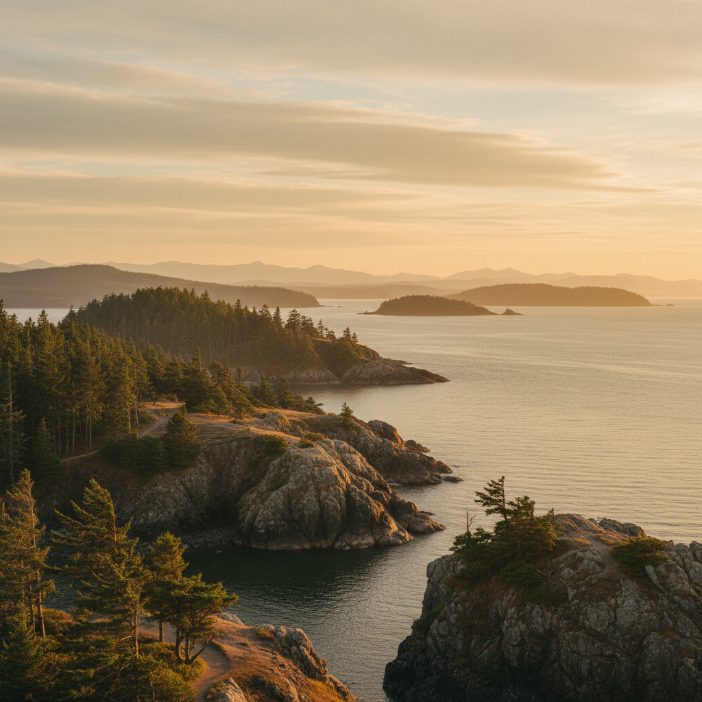
Larrabee State Park, Washington's oldest state park, spans 2,748 acres along the saltwater shores of Samish Bay and the western slopes of Chuckanut Mountain. Established in 1915, the park originated from a 20-acre land donation by Frances Larrabee, honoring the vision of her late husband, Charles X. Larrabee, and Governor Ernest Lister. Initially named Chuckanut State Park, it was officially renamed in 1923 to honor the Larrabee family. Today, this expansive public reserve sits on the traditional territory of the Coast Salish peoples, including the Samish and Lummi nations, who have harvested shellfish and navigated these waters for millennia. The park serves as a critical point where the dense, temperate rainforest of the Chuckanut Mountains meets the marine environment of the Salish Sea.
The park's distinctive geology is defined by the Chuckanut Formation, an ancient sequence of sandstone, siltstone, and conglomerate laid down by a massive river delta system roughly 50 million years ago. Over time, tectonic forces uplifted these sedimentary layers, while wind and waves sculpted the shoreline into dramatic rock formations and tide pools. At Clayton Beach, located on the southern end of the park's 8,100 feet of shoreline, visitors can observe honeycomb weathering, a geological phenomenon where saltwater spray creates intricate, pocket-like patterns in the sandstone. During low tide, these sandstone shelves trap water to form rich marine habitats teeming with purple sea stars, green sea anemones, hermit crabs, and small sculpins.
Inland, Larrabee State Park features 18 miles of trails that wind through a lush canopy of Douglas fir, Western red cedar, Western hemlock, and bigleaf maple. The popular Fragrance Lake Trail climbs steadily through the forest, gaining about 1,000 feet of elevation over 1.9 miles to reach a quiet, freshwater lake surrounded by ancient trees. For a longer trek, hikers can continue to Lost Lake or connect to the Interurban Trail, which follows the historic route of the electric railway that once ran between Bellingham and Mount Vernon. Water enthusiasts can launch kayaks, canoes, or paddleboards from the boat launch at Wildcat Cove, though navigating the shallow cove requires careful attention to the tide charts. The park also hosts a 51-site standard campground, 26 utility sites, and two reservable picnic shelters built near the main day-use area, allowing visitors to sleep under the forest canopy within earshot of the gentle waves of Samish Bay.
Check the local tide charts before visiting Clayton Beach to ensure you arrive during a low tide, which exposes the intricate honeycomb sandstone formations and marine life in the tide pools. If you plan to launch a kayak or boat from Wildcat Cove, be aware that the shallow launch is difficult or impossible to use during low tide cycles.