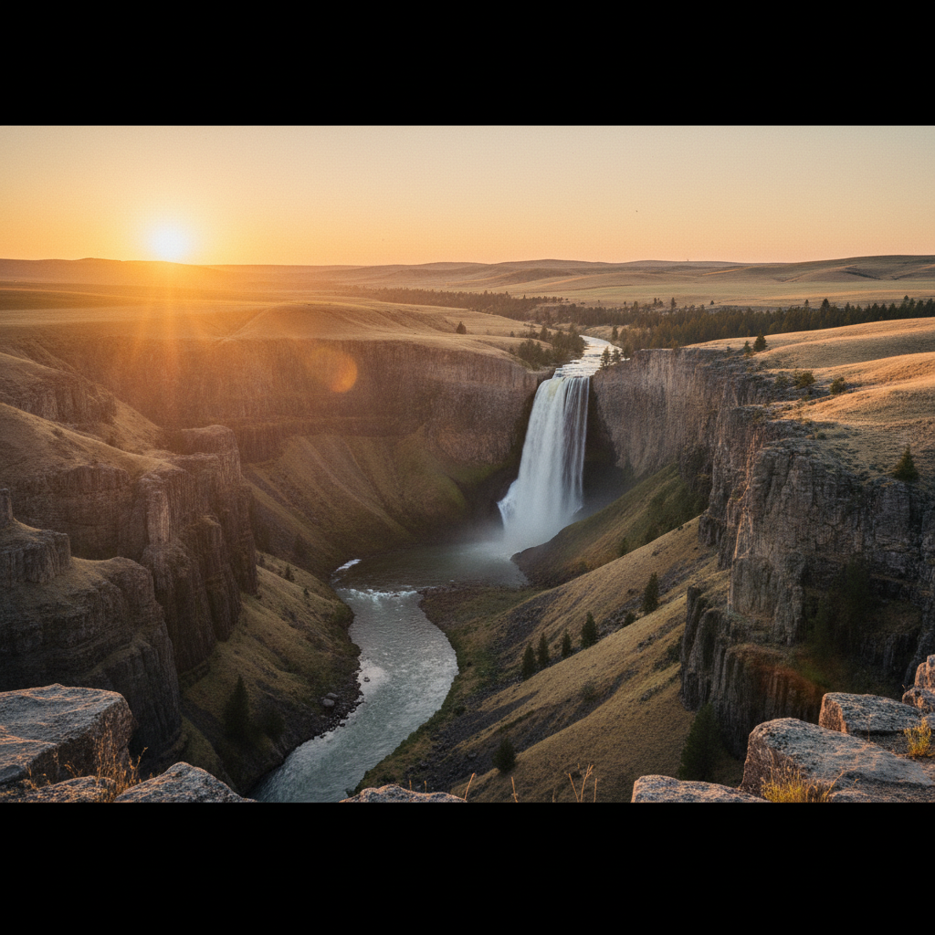
Washington's official state waterfall: a 198-foot plunge into a basalt canyon carved by Ice Age floods.
Palouse Falls plunges 198 feet over a sheer cliff of columnar basalt into a massive, circular plunge pool. Located within a 94-acre state park in southeastern Washington, this dramatic geological feature became the official state waterfall in 2014, following a successful lobbying campaign by elementary school students from the nearby town of Washtucna. The state park provides an intimate yet safe encounter with this powerful cascade, primarily from the paved Fryxell Overlook. Because of the sheer drop-offs and fragile soils of the canyon, the park service has restricted hiking strictly to this 0.1-mile designated path, keeping visitors safely on the rim while protecting the surrounding habitat. From this vantage point, the sensory experience is immediate: the constant, low-frequency rumble of the water vibrates through the rock, and a cool, fine mist rises from the depths of the canyon to cut through the dry, sage-scented air of the plateau.
The Palus (Palouse) people, who lived in the village of Palus at the confluence of the Palouse and Snake rivers, called the falls Aputaput, which translates to "Falling Water". In Palus oral tradition, the canyon's dramatic geography was born during an epic battle between five giant Wolf Brothers and a legendary giant Beaver named Wishpushya. As Wishpushya fought for survival, his claws gouged out the vertical fissures and columns of the basalt cliffs, and his thrashing tail carved the deep plunge pool at the base of the falls. His petrified heart was said to rest at the river's mouth, a sacred landmark from which the Palus people believe they were created. The tribe, renowned as expert horse breeders and traders on the Columbia Plateau, also lent their name to the distinctive spotted Appaloosa horse.
Geologically, the 377-foot-deep canyon exposes a massive cross-section of the Columbia River Basalt Group, carved by the cataclysmic Missoula Floods between 12,000 and 15,000 years ago. During the last Ice Age, glacial ice dams holding back Lake Missoula repeatedly ruptured, releasing torrents of water that swept across eastern Washington. This immense volume of floodwater overtopped the ancestral valley of the Palouse River, forcing it south and eroding a new, deep canyon through the fractured basalt to meet the Snake River. Today, Palouse Falls is one of the very few active waterfalls remaining along this ancient glacial flood path, serving as a monument to the unimaginable hydraulic forces that reshaped the entire region in a matter of days.
Arrive in late spring when snowmelt swells the river to its peak flow. Because the canyon faces west, the late afternoon sun illuminates the basalt columns in warm, golden light. A Discover Pass is required for parking, and visitors must stay strictly on the paved overlook trail, as all lower canyon trails are closed for safety.