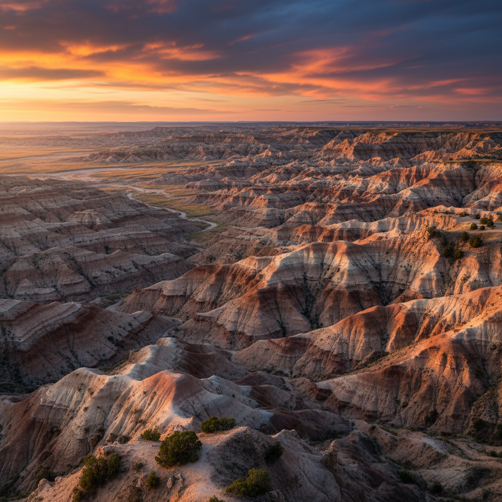
Sharp buttes, ancient fossil beds, and vast mixed-grass prairie in southwestern South Dakota.
Badlands National Park, known to the Oglala Lakota as Makȟóšiča, spans 244,000 acres of sharply eroded buttes, pinnacles, and spires in southwestern South Dakota. The dramatic, layered landscape is a physical archive of deposition and erosion, where sedimentary layers stacked like a giant cake reveal millions of years of earth history. The story begins roughly 75 million years ago with the dark Pierre Shale, deposited at the bottom of a shallow Cretaceous sea. As the waters receded, the upper shale oxidized into the mustard-colored Yellow Mounds. Above this lies the late Eocene Chadron Formation, a gray claystone deposited by ancient rivers when the climate was warm and subtropical. The Oligocene Brule Formation follows, marked by tan and pink layers of siltstone and sand, while the uppermost Sharps Formation contains a thick band of light-colored volcanic ash carried by the wind from massive eruptions in the Great Basin. For the past 500,000 years, the Cheyenne and White Rivers, along with wind and rain, have carved these soft sediments at a rapid rate of roughly one inch per year, constantly sculpting new canyons and sharp ridges.
This rapid erosion continuously uncovers one of the world's richest Oligocene fossil beds, providing researchers with an unparalleled look at mammalian evolution. Millions of years ago, as the region transitioned from subtropical forests to cooler, drier scrublands, a diverse array of prehistoric beasts roamed this terrain. Paleontologists have unearthed the fossilized remains of three-toed horses, saber-toothed cats, sheep-like oreodonts, and massive, rhinoceros-like titanotheres. Today, the park's expansive mixed-grass prairie, the largest undisturbed tract of its kind in the United States, supports a vibrant modern ecosystem. Bison graze on the grassy tables, while bighorn sheep scale the crumbling cliffs, pronghorn race across the flats, and black-tailed prairie dogs chatter in extensive underground towns. The park is also a critical reintroduction site for the highly endangered black-footed ferret, which hunts prairie dogs under the cover of night.
The park is divided into two main sections: the heavily visited North Unit and the remote South Unit, also known as the Stronghold District. The Stronghold District is located entirely within the Pine Ridge Indian Reservation and is co-managed by the National Park Service and the Oglala Lakota Nation, preserving lands of immense spiritual and historical significance. In the North Unit, the 39-mile Badlands Loop Road offers access to several dramatic trails. The Notch Trail leads hikers through a narrow canyon, up a 50-foot wooden log ladder, and along a narrow cliff edge to a panoramic view of the White River Valley. The Castle Trail, the park's longest path at five miles one way, stretches between the Fossil Exhibit Trail and the Door and Window parking area, winding through rugged formations and open prairie. Near the Ben Reifel Visitor Center, the Fossil Preparation Lab allows visitors to watch paleontologists clean and catalog newly discovered specimens, bridging the deep past with the active research of the present.
Hike the Notch Trail in the late afternoon to ascend the wooden log ladder and reach the ledge just as the low sun illuminates the White River Valley.