Vast West Texas wilderness where the Rio Grande carves deep limestone canyons below the volcanic peaks of the Chisos.
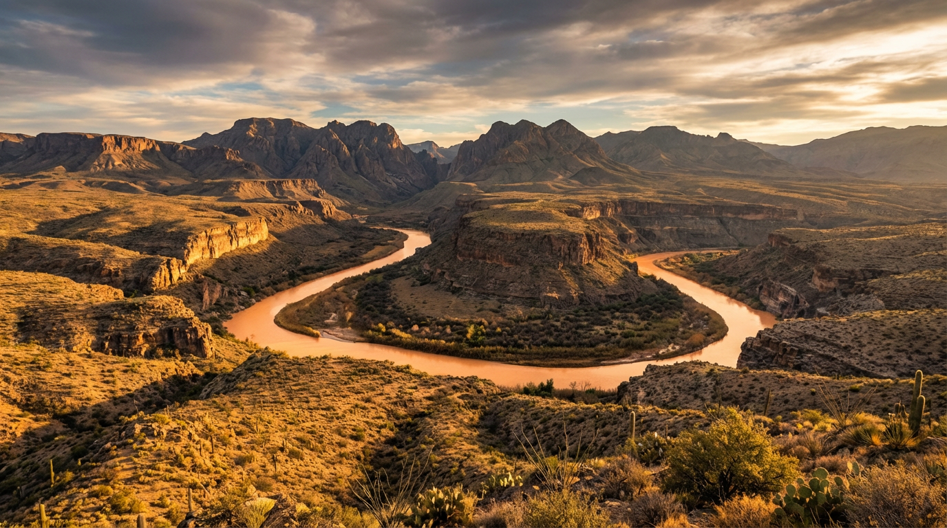
Big Bend National Park preserves over 801,000 acres of West Texas wilderness where the Chihuahuan Desert collides with the high, forested peaks of the Chisos Mountains. Named for the massive, sweeping curve of the Rio Grande, which is known south of the border as the Río Bravo del Norte and historically to Pueblo peoples as P'osoge, this vast sanctuary serves as a critical ecological crossroads. The park protects the entire Chisos range, the only complete mountain chain in the United States fully contained within a single national park boundary. These jagged peaks, rising abruptly from the arid flats, are the eroded remnants of ancient volcanic activity and tectonic shifts that occurred millions of years ago, creating a cool, montane "sky island" that shelters isolated populations of ponderosa pine, Douglas fir, and Arizona cypress.
The human history of this rugged landscape spans nearly ten millennia, starting with nomadic Paleo-Indian and Archaic hunter-gatherers who left behind rock art and stone tools. For centuries, the region was a stronghold and refuge for Indigenous groups, including the Chizo, Comanche, and the Chisos Apache, whose last great leader, Chief Alsate, is remembered in local lore. In the late nineteenth and early twentieth centuries, Spanish explorers, Mexican farmers, Anglo ranchers, and cinnabar miners all attempted to carve out livelihoods from the unforgiving terrain, leaving behind historic structures like the Castolon store and the remnants of the quicksilver mines near Terlingua. The park itself was authorized by Congress in 1935, developed in part by the young men of the Civilian Conservation Corps who built the road into the Chisos Basin, and formally established on June 12, 1944.
Exploring the park requires navigating three distinct environments, each with its own microclimate and sensory details. In the high Chisos Basin, trails like the Window Trail and the steep climb to Emory Peak lead through shaded canyons where the air smells of pine needle and damp stone. Descending along the Ross Maxwell Scenic Drive, the landscape transitions back to the classic Chihuahuan Desert, where creosote, lechuguilla, and ocotillo spread across the gravel plains toward the sheer limestone walls of Santa Elena Canyon. Here, the river has sliced a dramatic 1,500-foot-deep gorge through the Mesa de Anguila, creating a cool, shaded corridor where visitors can walk along the muddy banks. Farther east, the historic J.O. Langford Hot Springs offer a place to soak in 105-degree mineral waters directly beside the flowing river, under some of the darkest, most star-filled night skies in North America.
Because the park covers over 800,000 acres, driving times between key areas like the Chisos Basin, Castolon, and Rio Grande Village can easily take an hour or more. Focus on one region per day, carry at least one gallon of water per person daily, and make sure to fill up your gas tank at Panther Junction or Rio Grande Village before heading down the remote scenic drives.