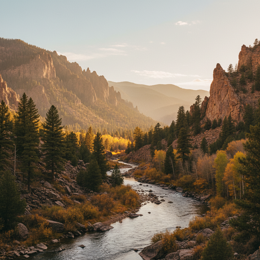
Carved by its namesake river, this dramatic canyon features towering vertical cliffs, a premier trout stream, and cool ponderosa forests within the Cimarron Range.
Cimarron Canyon State Park encompasses an eight-mile stretch of rugged canyon along the Cimarron River in northern New Mexico, serving as the centerpiece of the 33,116-acre Colin Neblett Wildlife Area. Situated at an elevation of 7,876 feet, the park provides a cool, forested respite from the surrounding high plains, with dense stands of ponderosa pine, Douglas fir, and Gambel oak lining the canyon walls. The park's most prominent geological feature is the Palisades Sill, a colossal formation of porphyritic dacite emplaced approximately 40 million years ago during the tectonic uplift of the southern Rocky Mountains. These sheer cliffs tower more than 300 feet above the riverbed, their vertical, columnar-jointed faces catching the shifting alpine light in shades of ochre, rust, and slate gray. Wildlife thrives in this protected corridor, where mule deer, elk, black bears, and wild turkeys frequently move through the timber, and bighorn sheep occasionally navigate the steep, rocky ledges.
The Cimarron River is a highly regarded tailwater fishery, sustained by cold water releases from the Eagle Nest Dam just upstream. The New Mexico Department of Game and Fish actively manages the river, maintaining a dense trout population of approximately 3,000 fish per mile, primarily consisting of wild brown trout and stocked rainbow trout. Anglers are drawn to the river's riffles and deep pools, particularly the 1.8-mile stretch on the western end of the park designated as Special Trout Water, which carries strict tackle regulations and catch limits. For those looking to explore on foot, the Clear Creek Trail offers a rewarding route that starts near mile post 292 on the south side of the canyon. The trail follows the rushing creek for 1.6 miles, crossing the water on simple log bridges and passing several small, cascading waterfalls before ascending a steep ridge that opens up to expansive views of the Cimarron Range.
Overnight accommodations within the park are spread across four developed campgrounds: Tolby, Ponderosa, Maverick, and Blackjack. Tolby Campground features the park's visitor center, while Blackjack is reserved exclusively for tent camping. Maverick Campground, located near the eastern end of the park, is situated adjacent to the Gravel Pit Lakes, a series of small, placid ponds created when gravel was excavated to build U.S. Route 64. Today, these ponds are regularly stocked with trout, offering an easy alternative to the moving water of the river. Campers should prepare for a rustic experience, as none of the campsites feature electrical or water hookups, and the park's water systems and comfort stations are shut down for the winter from October 1 to May 1. Additionally, visitors planning to hike the backcountry trails within the surrounding wildlife area must hold a valid park permit, fishing license, or GAIN permit, and should note that trails like Tolby and Maverick close seasonally from mid-May through July to protect nesting wildlife.
To escape the swifter currents of the river, head to the Gravel Pit Lakes day-use area near the Maverick Campground. These quiet, spring-fed ponds are regularly stocked with rainbow trout and offer an easy, peaceful spot for bank fishing or a picnic. If you arrive at dawn, you might catch a glimpse of elk or mule deer drinking from the misty shoreline.