The largest national monument in the contiguous United States, spanning nearly 1.9 million acres of cliffs, plateaus, and canyons.
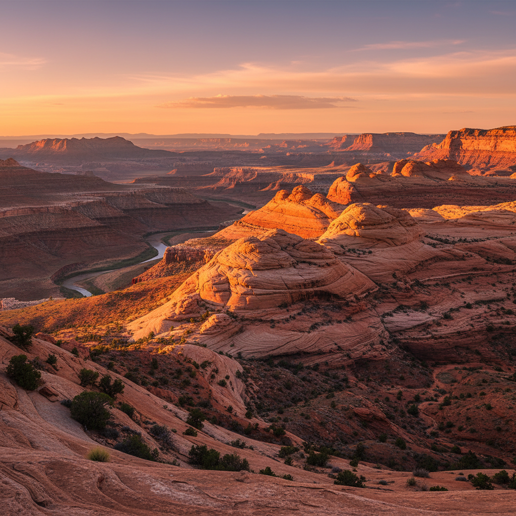
Grand Staircase-Escalante National Monument encompasses nearly 1.87 million acres of rugged public land in southern Utah, making it the largest national monument in the contiguous United States. Designated in 1996 by President Bill Clinton, the monument was the first unit of the Bureau of Land Management's National Conservation Lands system. The vast territory was the last portion of the lower 48 states to be formally mapped by cartographers, remaining a remote frontier of deep canyons, high plateaus, and exposed geologic strata. The monument is divided into three distinct geographic regions: the Grand Staircase in the west, the high and arid Kaiparowits Plateau in the center, and the deeply carved Canyons of the Escalante in the east.
The western section of the monument, the Grand Staircase, is named for a dramatic geologic sequence first conceptualized by geologist Clarence Dutton in the 1870s. This series of massive stepped plateaus descends from Bryce Canyon south toward the Grand Canyon, with each step representing millions of years of deposition and erosion. The cliffs are named for their distinctive colors: the Pink Cliffs, Gray Cliffs, White Cliffs, Vermilion Cliffs, and Chocolate Cliffs. To the east, the Kaiparowits Plateau rises as a wild, triangular wedge of Late Cretaceous rock, holding one of the most complete records of dinosaur-era ecosystems in the world. Paleontologists working within the monument have unearthed dozens of previously unknown dinosaur species, alongside ancient turtles, crocodiles, and early mammals, making the monument a critical open-air laboratory for scientific research.
The easternmost region, the Canyons of the Escalante, features a labyrinth of narrow slot canyons, towering arches, and hidden alcoves carved by the Escalante River and its tributaries. This section preserves a rich human history, serving as the traditional homeland of the Ancestral Puebloan and Fremont peoples, who farmed the river canyons and built sandstone granaries to store their crops. Today, their descendants, including members of the Hopi, Paiute, Zuni, Ute, and Navajo nations, maintain deep cultural ties to this landscape, which is marked by ancient rock art panels and archaeological sites. Exploring the monument requires careful preparation, as water is scarce, summer temperatures routinely exceed 100 degrees Fahrenheit, and many of the trailheads are accessed via rough, unpaved routes like the washboarded Hole-in-the-Rock Road.
Secure your free backcountry permit at the Escalante Interagency Visitor Center before heading down Hole-in-the-Rock Road, and always pack extra water and a map, as GPS signals are unreliable in the deep canyons.