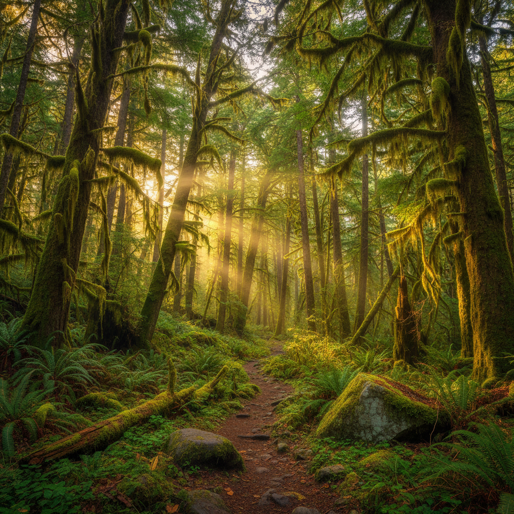
A deep green wilderness of moss-draped bigleaf maples, giant Sitka spruce, and glacial waters along the Olympic Peninsula's premier river trail.
The Hoh Rainforest Trail system, situated on the traditional lands of the Chaláat (Hoh) people, who call the river Chalak'At'sit, and the Quinault peoples, represents one of the most intact temperate rainforest corridors in North America. Located on the western slopes of the Olympic Peninsula, this network of paths begins at the Hoh Rain Forest Visitor Center and immediately plunges into a dense, primeval canopy dominated by massive Sitka spruce and bigleaf maples. These ancient trees, some towering over 300 feet tall, are draped in thick curtains of club moss and surrounded by lush understories of sword ferns and huckleberry. The constant moisture, with the region receiving more than 140 inches of precipitation annually, fosters a quiet, sound-dampening atmosphere where the forest floor is cushioned by deep mosses and decaying nurse logs that nourish the next generation of conifers.
Day hikers typically focus on the two short, family-friendly loops that branch directly from the visitor center. The Hall of Mosses is an easy 0.8-mile loop with about 100 feet of elevation gain, showcasing a grove of bigleaf maples heavily draped in hanging gardens of club moss. Adjacent to it, the Spruce Nature Trail runs for 1.2 miles, winding through both old-growth and younger forests along Taft Creek and offering access to the gravel bars of the glacier-fed Hoh River. For those seeking a deeper wilderness experience, the main Hoh River Trail stretches 17.4 miles one way from the trailhead to Glacier Meadows. This out-and-back route remains relatively flat for the first 13 miles as it traces the river valley, passing through a series of backcountry campsites including Mount Tom Creek at mile 2.9, Five Mile Island at mile 5.0, Happy Four at mile 5.7, and the historic Olympus Guard Station at mile 9.1.
Beyond Lewis Meadow at mile 10.5, the trail transitions from a gentle valley walk to a steep, strenuous mountain ascent. Hikers cross the High Hoh Bridge at mile 13.3, suspended high above a deep canyon, before climbing steadily toward Elk Lake at mile 15.0 and finally reaching Glacier Meadows at 4,300 feet of elevation. This upper section of the trail requires navigating challenging obstacles, including a steep avalanche chute equipped with a rope ladder to assist hikers down a loose rock slope. From Glacier Meadows, a short, steep spur leads to the terminal moraine of the Blue Glacier on Mount Olympus, where the lush, moss-draped forest gives way to a stark landscape of ice and stone. Backcountry permits are required for all overnight stays along the trail, and bear canisters are mandatory for food storage to protect local wildlife, which includes black bears, cougars, and the resident herds of Roosevelt elk.
Arrive at the trailhead before 8:00 a.m. during summer months to avoid multi-hour vehicle backups at the entrance station. For overnight trips, secure your backcountry permit well in advance via Recreation.gov, and borrow a hard-sided bear canister from the Wilderness Information Center, as they are mandatory for overnight stays.