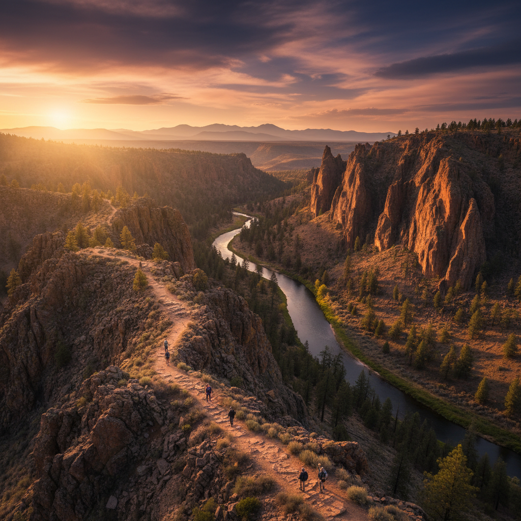
The signature high-desert climb of Smith Rock, scaling steep volcanic tuff to reveal dramatic panoramas of the Cascade Range and the iconic Monkey Face pillar.
The Misery Ridge Trail is the defining hiking route of Smith Rock State Park, a steep and unyielding pathway that climbs directly into the heart of Oregon's volcanic history. Starting from the canyon floor just across the Crooked River footbridge, the trail wastes no time, immediately launching into a series of tight, dusty switchbacks that gain roughly 900 feet of elevation in under a mile. The trail surface is composed of loose volcanic soil and gravel, requiring deliberate footing amid the scattered juniper trees and sagebrush. This demanding ascent is a direct encounter with the Smith Rock Tuff, a massive deposit of welded tuff and ash created 30 million years ago during the collapse of the ancient Crooked River Caldera. As hikers ascend, the sheer scale of the orange and cream-colored cliffs becomes apparent, with the Crooked River tracing a sharp horseshoe bend directly below.
Reaching the flat, windswept summit of the ridge reveals a stark, panoramic view of the high desert and the distant peaks of the Cascade Range, including Mount Jefferson, Mount Hood, and the Three Sisters. The trail continues along the spine of the ridge, guiding hikers toward the park's most famous geological feature: Monkey Face. This 350-foot freestanding pillar of rock, which indeed resembles the profile of a grinning primate, is a legendary monument in the rock-climbing world. From the trail's vantage point near the Mesa Verde junction, hikers can often watch climbers tackling the sheer, overhanging routes of the pillar's mouth and nose. The geology here is a complex tapestry, where the ancient tuff is capped by dark basalt flows that originated from the Newberry Volcano vents hundreds of thousands of years ago, later carved into deep canyons by the relentless flow of the river.
The descent from the ridge can be completed as a loop by connecting with either the Mesa Verde Trail or the River Trail, each offering a distinct perspective of the canyon. Choosing the western descent leads down a series of steep, gravel-slick switchbacks directly past the base of Monkey Face before flattening out along the banks of the Crooked River. This lower section of the trail runs parallel to the water, where the dry desert air is replaced by the cool, damp microclimate of the riverbank, home to nesting golden eagles, river otters, and canyon wrens. The loop concludes by retracing the path back to the footbridge and conquering 'The Chute,' a short but steep paved path that leads back up to the park's main parking area and welcome center. Completing this 3.7-mile trek requires sturdy footwear and plenty of water, especially during the hot summer months when the exposed rock walls radiate intense heat.
Hike the loop clockwise to climb the steepest, dustiest switchbacks first. This saves your knees on the descent and gets the hardest work out of the way before the high-desert heat peaks.