Atop Mount Woodson, the famous Potato Chip Rock juts out over the void, a thin slab of granite daring you to step onto its edge.
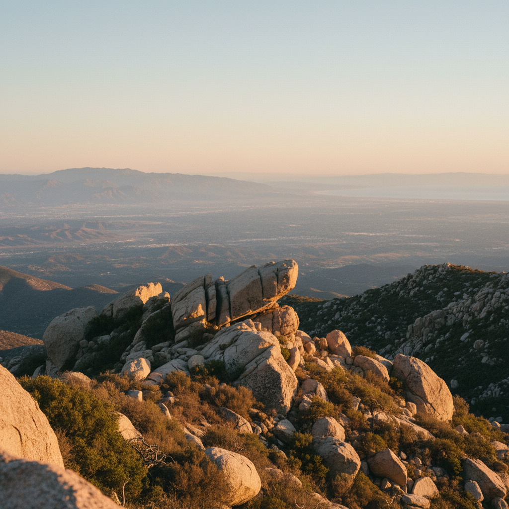
The climb up Mount Woodson begins in the chaparral of north San Diego County, where the scent of black sage and wild lilac hangs in the dry heat. Giant, rounded granite boulders, some the size of houses, litter the slopes like marbles discarded by giants. Ascending from the shores of Lake Poway, the trail wastes no time, tilting upward into a relentless, sun-exposed grind. The coastal breeze quickly fades, replaced by the radiating warmth of the stone. Every bend in the trail reveals a wider view of the arid inland valleys, but your eyes are drawn back to the massive grey outcroppings that crown the ridge. The summit, rising to an elevation of 2,881 feet, is a jumble of these ancient boulders, topped by a bristling forest of radio antennas and the improbable sliver of stone that has made this mountain famous.
This landscape is part of the Peninsular Ranges Batholith, a vast plume of magma that cooled slowly beneath the earth's surface over a hundred million years ago. Uplift and erosion eventually stripped away the overlying soil, exposing these massive plutons. The famous Potato Chip Rock itself, located about 100 yards below the actual summit, is a product of spheroidal weathering, where water and temperature swings cause the outer layers of granite to flake off like an onion, leaving a thin, cantilevered ledge suspended over a deep gap. Long before hikers sought out this geological oddity, the Kumeyaay people held these mountains as sacred, knowing the peak as Ewiiy Hellyaa, which translates to the Mountain of the Moonlit Rocks. In tribal tradition, this was a place of power where the Moon sleeps, home to a mythical rabbit and stepped on by the spirit giant Toyapai on his way to the coast. Early American pioneers later dubbed the peak Cobbleback Peak, before it was renamed for Dr. Marshall Clay Woodson, a Confederate dentist who homesteaded at the mountain's base in 1895.
Reaching the summit ridge requires a sustained physical effort, whether you choose the steep, paved service road from Highway 67 or the longer, scenic dirt path winding up from the lake. At the top, the atmosphere is a mix of athletic triumph and social gathering. Hikers line up along the granite slabs, taking turns scrambling down onto the narrow, suspended flake of Potato Chip Rock for a photo that captures the illusion of standing on the edge of the world. Beyond the photo-op, the true reward is the expansive panorama. On a clear morning, after the marine layer peels back, you can look west across the coastal plains to the blue horizon of the Pacific Ocean, while to the east, the rugged peaks of the Cleveland National Forest ripple toward the desert.
To avoid the crowds and the midday heat, start your hike at first light. The Highway 67 approach is shorter but paved and brutally steep; the Lake Poway route is longer and more scenic but charges a $10 parking fee for non-residents on weekends and holidays. Bring at least three liters of water, as there is absolutely no shade on the trail.