Cross Palo Flechado Pass on the Enchanted Circle Scenic Byway to experience a historic mountain passage through the high-alpine forests of the Sangre de Cristo Mountains.
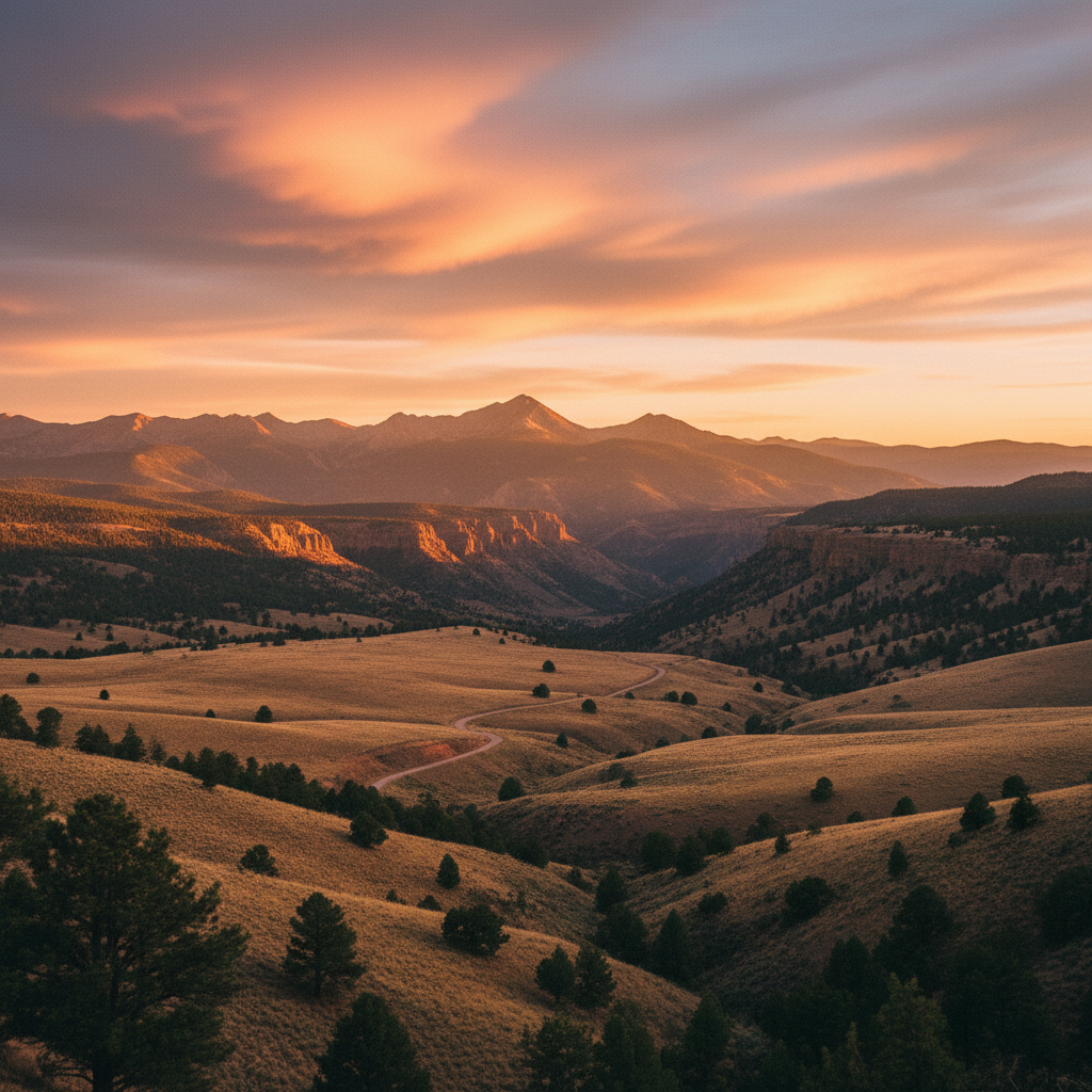
Palo Flechado Pass rises to an elevation of 9,107 feet (2,776 meters) along U.S. Route 64, cutting through the high country of the Sangre de Cristo Mountains between Taos and the Moreno Valley. Located about 19 miles east of Taos and 3.5 miles west of Agua Fria Creek, this paved mountain pass, also historically known as Taos Pass or Old Taos Pass, serves as a vital segment of the Enchanted Circle Scenic Byway. The road winds through the Carson National Forest, where dense stands of Engelmann spruce, subalpine fir, and ponderosa pine crowd the roadside. It is a critical ecological transition zone where the dry piñon-juniper woodlands of the lower Taos Valley give way to a cool, moist alpine environment. Travelers crossing the summit will notice the sharp drop in temperature and the rich, earthy scent of damp pine needles, especially during the summer and autumn months.
The name Palo Flechado translates from Spanish as "tree pierced with arrows". This moniker has deep roots in the region's Indigenous history, particularly linked to a Taos Pueblo tradition. Following successful buffalo hunts on the eastern plains, hunters would return through this mountain corridor and shoot their unused arrows into a specific tree at the summit as a ritual of thanksgiving. Long before Spanish colonizers arrived, the pass was a crucial thoroughfare for Apache, Comanche, and Kiowa bands traveling between the Great Plains and the Rio Grande valley along the Cimarron River, which was historically called La Flecha. In 1706, Spanish documents recorded a band of Apaches known as the Flecha de Palo living on the plains just east of these mountains, further cementing the area's historical association with the arrow-riddled trees. Later, 19th-century traders and settlers used the pass as a rugged bypass connected to the Santa Fe Trail system.
Today, the pass is a gateway to several backcountry adventures. Just off the highway, the Elliot Barker Trail system offers a six-mile loop that climbs to around 9,600 feet, providing views of the Moreno Valley, Eagle Nest Lake, and the Wheeler Peak Wilderness. For those seeking a gentler, streamside walk, the La Jara Trail parallels a flowing creek along Forest Road 5 in La Jara Canyon, located just west of the pass. Mountain bikers can utilize the intermediate 1.9-mile Palo Flechado Multi Trail, a singletrack connection built by volunteers and the Enchanted Circle Trails Association that links the pass directly to the Elliot Barker Trail at Bull Springs Meadow. In late September, the entire pass transforms as dense groves of quaking aspen turn a brilliant, shimmering gold against the dark green conifers. Winter brings heavy snow to the pass, converting the hiking trails into quiet corridors for snowshoers and cross-country skiers.
Time your visit for late September to see the aspen groves turn brilliant gold, and look for the historic marker near the summit detailing the pass's Indigenous history. For a quick, scenic detour, pull off at the Elliot Barker Trailhead just east of the summit to walk down to a peaceful mountain pond.