Pictograph Cave State Park, located just south of Billings, Montana, preserves a highly significant archaeological site where three sandstone caves showcase over 2,000 years of Indigenous rock art and history.
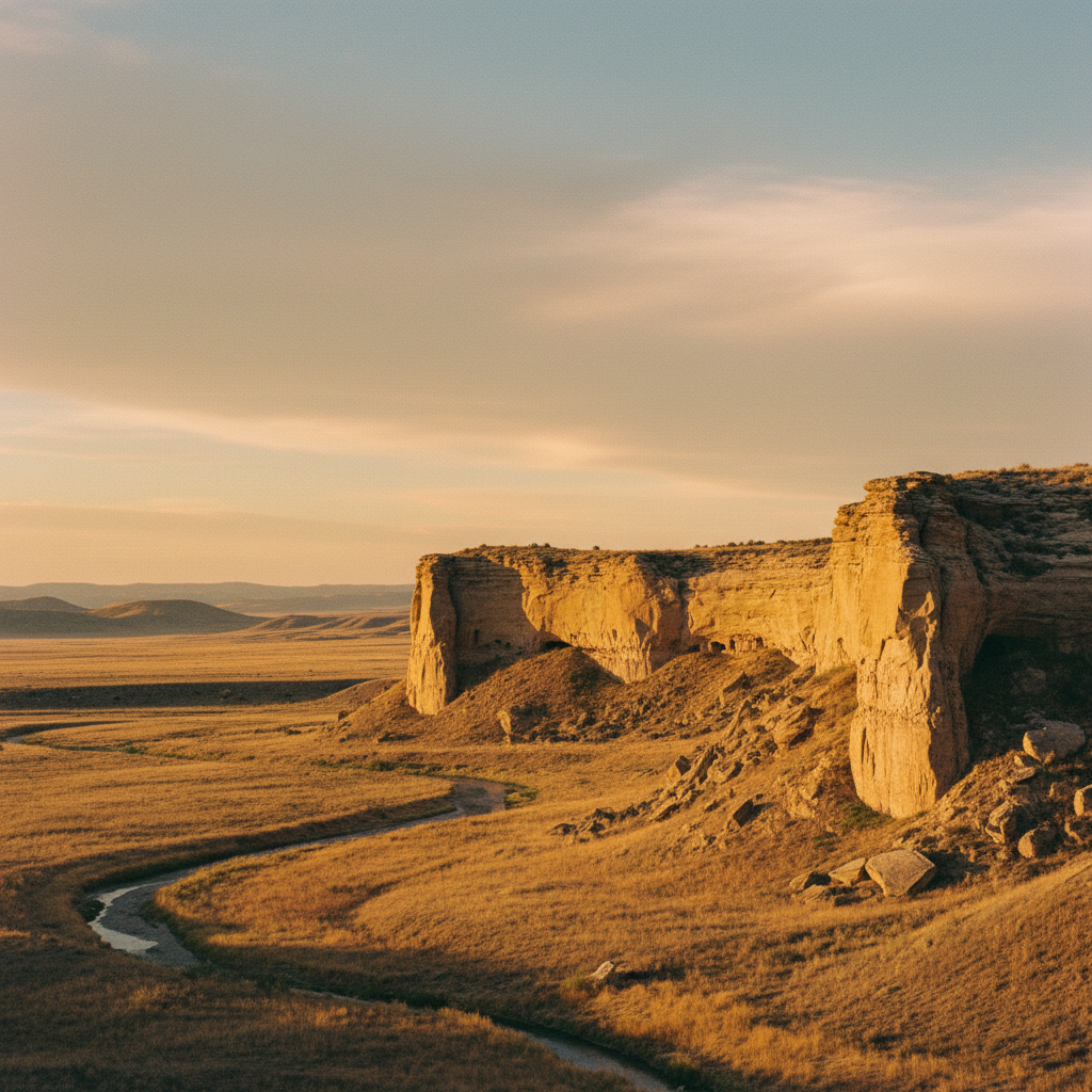
Pictograph Cave State Park preserves one of the most significant archaeological rock art sites in the Northwestern Plains. Located just south of Billings, Montana, the 23-acre park centers on three natural rock shelters carved into the weakly consolidated Eagle Sandstone: Pictograph, Middle, and Ghost caves. For the Apsáalooke (Crow) people, this ancestral land is known by the phrases Ammaáhpawaalaatuua, meaning 'where there is rock writing,' and Alahpaláaxawaawaalaatuua, meaning 'where there is ghost writing.' The site was a vital sanctuary and campground for nomadic hunters for millennia. The sandstone overhangs provided shelter from the elements, while the nearby confluence of Bitter Creek and the Yellowstone River offered water and resources. Today, the park is a quiet space of historical contemplation, where visitors can trace the physical and spiritual footprints of the region's earliest inhabitants.
The archaeological legacy of the caves is remarkably deep. Beginning in 1937, excavations funded by the Works Progress Administration and led by researchers like H. Melville Sayre, Oscar Lewis, and eventually William Mulloy unearthed more than 30,000 artifacts from the cave floors. These discoveries, which included stone projectile points, bone scrapers, ornamental beads, and ancient fire pits, allowed Mulloy to establish the first definitive chronological framework for Northern Plains cultures. While Ghost Cave and Middle Cave yielded abundant physical artifacts, Pictograph Cave, the largest of the three at 160 feet wide and 45 feet deep, is the only one that retains visible rock art. More than 100 distinct pictographs have been documented on its walls, painted with natural pigments of red iron oxide, black charcoal, and white clay. The oldest of these drawings, a depiction of a turtle, has been radiocarbon-dated to more than 2,100 years old, while more recent additions date to the period of early European contact.
Exploring the park today involves a three-quarter-mile interpretive loop trail that connects all three caves. The path is paved and wheelchair-accessible for the first quarter-mile leading directly to the mouth of Pictograph Cave, before transitioning to a gravel loop that leads past Middle Cave and Ghost Cave. Because natural weathering, water seepage, and early twentieth-century vandalism have faded roughly 85 percent of the rock art, the park provides viewing scopes and detailed interpretive signs to help visitors identify the remaining figures. Look closely to spot warriors holding shields, bison, and horses, as well as a historic scene believed to depict a Blackfeet ambush of fur trappers in 1823, rendered with a beaver, seven rifles, and 23 dashes. Before or after the hike, the 2,900-square-foot visitor center, which opened in 2009, offers essential context, showcasing a selection of the excavated bone tools, weapons, and historical replicas that help bring this ancient crossroads back to life.
Bring a high-quality pair of binoculars and plan your visit for the morning, when the sunlight hits the sandstone walls at an angle that makes the faint red and black pigments of the pictographs easier to distinguish. If you are visiting during the summer, watch the trail edges closely: the warm sandstone cliffs are also active habitat for prairie rattlesnakes.