A high-country haven on the Colorado-New Mexico border, where historic coal-mining ruins meet volcanic cliffs, forested trails, and trout-stocked lakes.
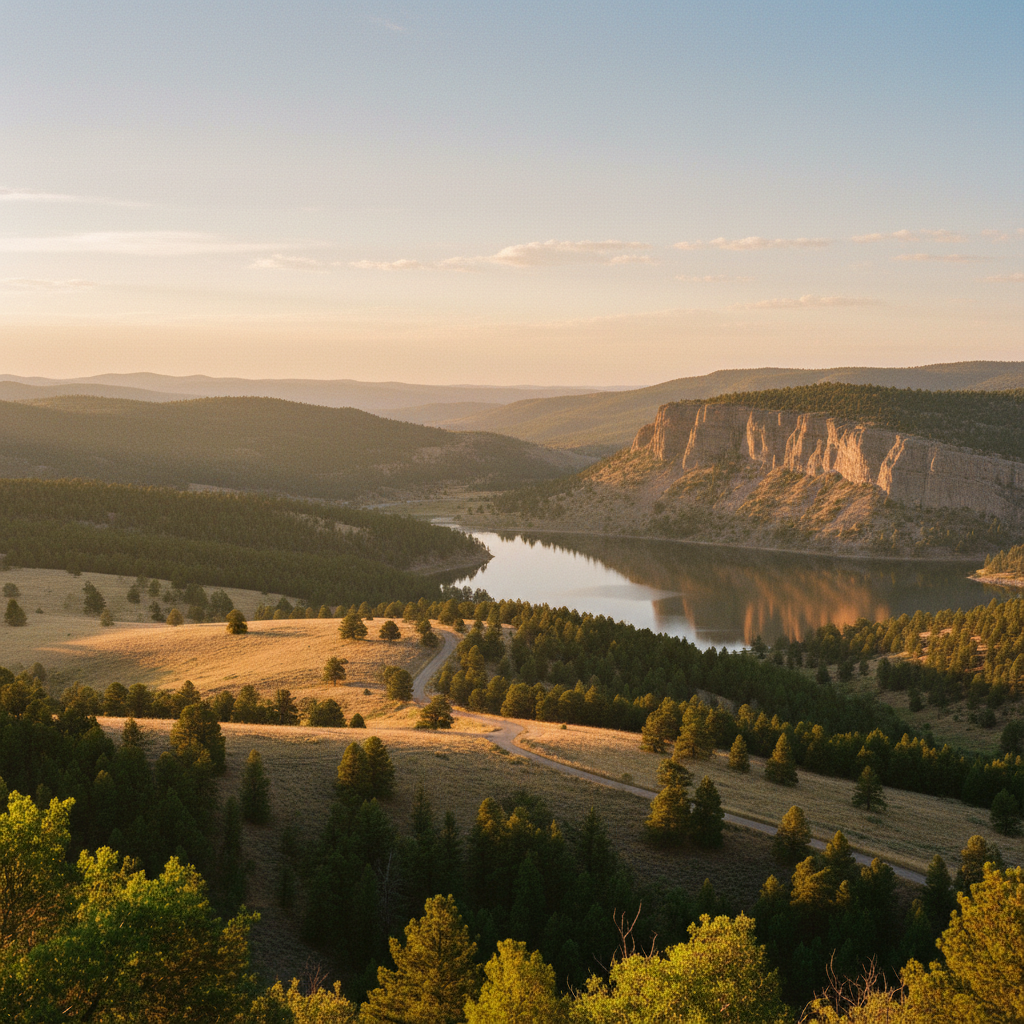
Sugarite Canyon State Park preserves a dramatic transition where the high plains of northeastern New Mexico fracture into deep, pine-scented canyons. Located six miles northeast of Raton along Highway 526, the 4,000-acre park ranges in elevation from 6,900 to 8,400 feet, creating a cool, well-watered refuge of ponderosa pine, Douglas fir, Gambel oak, and white-barked aspens. The canyon's striking topography is defined by dark, columnar basalt cliffs, which cap the surrounding mesas like Little Horse Mesa and Chicorica Mesa. These volcanic caps, remnants of ancient flows from the Raton-Clayton Volcanic Field, protect the softer sedimentary layers below: the coal-bearing Raton Formation, Trinidad Sandstone, and Pierre Shale. Through the heart of the canyon flows Chicorica Creek, feeding two primary reservoirs: the five-acre Lake Alice and the expansive 120-acre Lake Maloya, whose deep, still waters reflect the steep, forested slopes of the Colorado-New Mexico borderlands.
Before it became a state park in 1985, the canyon was a loud, industrious coal-mining hub. From 1908 until the mines closed in 1941, the town of Sugarite was a bustling company camp operated by the St. Louis, Rocky Mountain, and Pacific Company. At its peak, the camp housed around 1,000 people, including a diverse workforce of immigrant miners from Europe and Japan who lived in neighborhoods segregated by nationality but labored together underground. Today, the park's Visitor Center is housed in the carefully restored red-brick Sugarite Post Office. Just outside, the Coal Camp Trail winds through the ruins of the settlement, guiding walkers past crumbling stone foundations, the remains of the old schoolhouse, sealed mine portals, and the massive stone barn that once housed the mules used to pull coal cars. Nature has largely reclaimed the old waste piles, turning what was once a scarred industrial site into a quiet landscape of wild wildflowers, Gambel oak, and reclaiming forest.
Recreation in the park centers around its trails, lakes, and campgrounds. Anglers frequent Lake Maloya to cast for stocked rainbow and brown trout, utilizing the boat ramp for kayaks, canoes, and electric trolling boats, as gasoline-powered motors are prohibited. Hikers can explore nearly twenty miles of trails, including the Lake-to-Lake Trail connecting the reservoirs, or the more demanding Opportunity Trail and Ponderosa Ridge Trail, which climb the steep canyon walls to the mesa tops. Overnight visitors can choose between two distinct campgrounds: Lake Alice Campground, which offers sixteen sites with electric and water hookups beneath the canyon canopy, and Soda Pocket Campground, a dry-camping area with twenty-three sites located on a high meadow with panoramic views of the surrounding volcanic landscape. This diverse habitat supports abundant wildlife, making it common to spot mule deer, elk, wild turkeys, and black bears moving quietly through the trees.
Skip the crowded lake shores and begin your visit at the restored post office, which now serves as the visitor center. From there, walk the Coal Camp Trail through the ruins of the mining town to see the old foundations and the historic mule barn without needing to drive up the steep canyon road.