A vast geologic wilderness of towering red sandstone escarpments, home to the swirling formations of Coyote Buttes, White Pocket, and the depths of Buckskin Gulch.
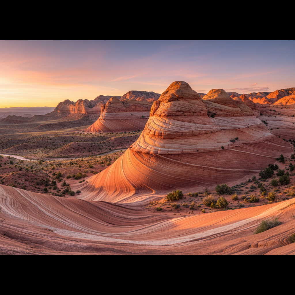
Vermilion Cliffs National Monument protects 293,689 acres of rugged desert wilderness across northern Coconino County, Arizona, directly bordering the Utah state line. Established on November 9, 2000, under Bureau of Land Management administration, this remote expanse is defined by the massive, multi-hued escarpment of the Vermilion Cliffs, which rise up to 3,000 feet above the desert floor. These cliffs are composed of layers of silt and ancient sand dunes, specifically the Moenkopi, Chinle, Kayenta, and Navajo sandstone formations, stained deep shades of red, pink, and ochre by iron oxide and manganese minerals. The flat Paria Plateau extends northward from the cliff tops, serving as a high-elevation tableland of windblown sand dunes and sparse sagebrush.
Within this geological wonderland lie some of the most sought-after backcountry destinations in the American Southwest. The Coyote Buttes region, particularly Coyote Buttes North, contains the famous Jurassic-era Navajo sandstone formation known as The Wave, where swirling, cross-bedded bands of pink, yellow, and orange rock resemble a frozen, undulating ocean. Due to the fragility of this sandstone, the Bureau of Land Management strictly limits access to Coyote Buttes through a highly competitive permit system. Further east across the sandy tracks of the Paria Plateau, White Pocket presents a chaotic, unpermitted alternative where twisted, brain-like mounds of white "cauliflower rock" clash with deep red sandstone, a result of ancient soft-sediment deformation or massive prehistoric landslides. The monument also encompasses Paria Canyon and Buckskin Gulch, the latter being one of the longest and deepest continuous slot canyons in North America, stretching for over 13 miles between towering, narrow walls of dark red stone.
Beyond its stone architecture, Vermilion Cliffs National Monument serves as a critical sanctuary for wildlife, most notably the endangered California condor. In partnership with The Peregrine Fund, the monument has hosted an annual condor release program since 1996, allowing visitors to occasionally spot these massive raptors with nine-foot wingspans soaring over the cliffs from a dedicated viewing site near House Rock Valley Road. Human history here is equally deep, with archaeological research documenting ancient Puebloan petroglyphs, historic ranching outposts, and the 1776 Dominguez-Escalante expedition route. Exploring this roadless monument requires careful preparation, high-clearance four-wheel-drive vehicles to navigate deep sand, and a commitment to self-reliance, as there are no paved roads, visitor centers, or potable water sources within its boundaries.
The Bureau of Land Management permits only 64 people (or 16 groups) to visit Coyote Buttes North daily. Apply for the advanced lottery on Recreation.gov four months ahead, or use the geofenced mobile app daily lottery while in the Kanab or Page areas.