The continental USA's northwest corner. Sea caves, seabirds, and the edge of America.
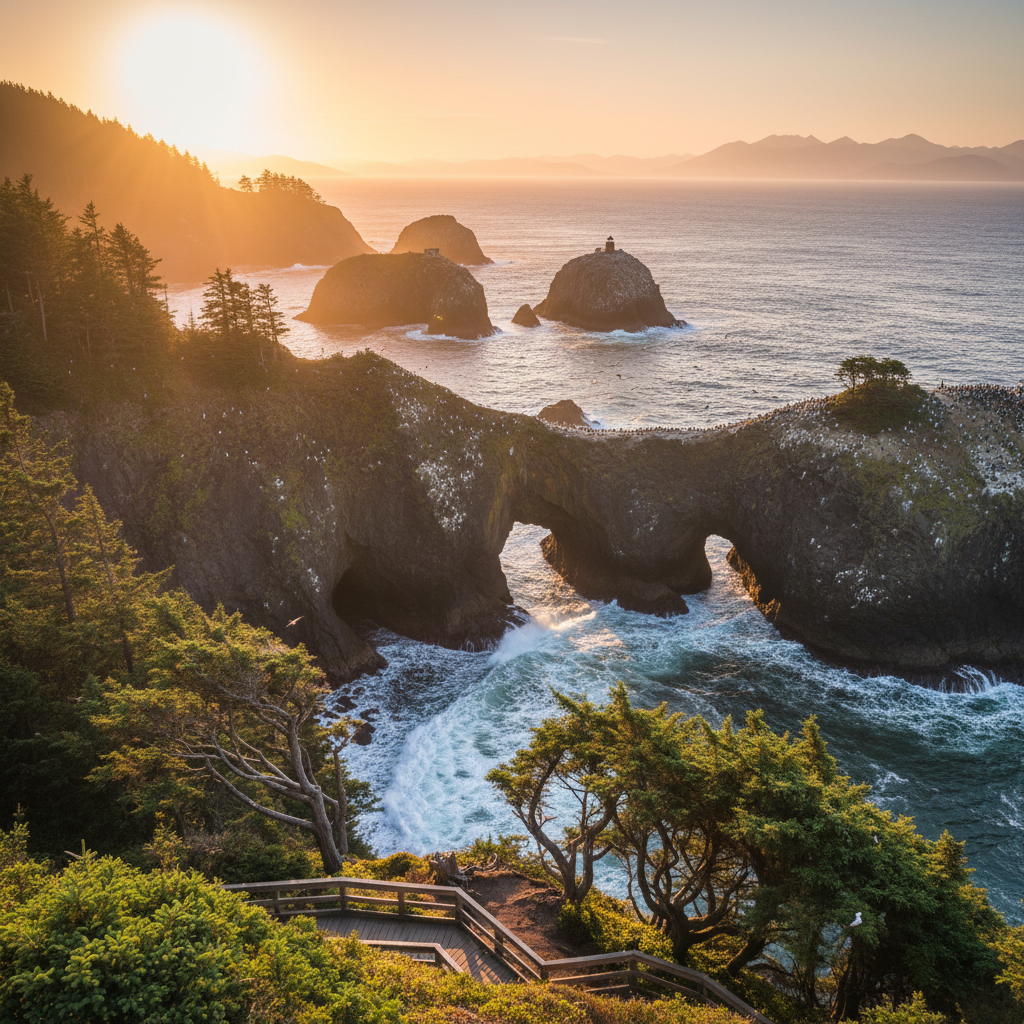
Cape Flattery occupies the absolute northwesternmost point of the contiguous United States, a dramatic precipice where the Strait of Juan de Fuca collides with the open Pacific Ocean. Owned and managed by the Makah Tribe, this rugged headland is accessible via a three-quarter-mile trail that descends through a dense, mist-shrouded coastal forest. The canopy is dominated by ancient, moss-draped Sitka spruce, western hemlock, and western red cedar, with a lush understory of salal, sword ferns, and huckleberry. As the trail drops approximately 200 feet in elevation, the smooth dirt path transitions into a series of raised cedar boardwalks and wooden steps designed to protect the fragile wetland bogs beneath. The air here is thick with the scent of damp earth and salt, and the low, resonant roar of the ocean grows steadily louder with every step toward the sea.
At the edge of the continent, the forest abruptly gives way to sheer basalt cliffs that plunge into the churning, jade-colored waters below. Over thousands of years, the relentless energy of winter storms has scoured the softer sedimentary rock, carving deep sea caves, narrow coves, and towering sea stacks. Four wooden observation platforms are perched along the cliffside, each offering a distinct vantage point of this geological battleground. Directly offshore, about a half-mile across a turbulent channel, sits Tatoosh Island. This 20-acre island was named after a prominent Makah chief and historically served as a summer base for tribal whale hunters and salmon fishermen. Atop the island sits the historic Cape Flattery Lighthouse, first lit in 1857 to guide ships safely into the Strait of Juan de Fuca, now decommissioned and replaced by a modern solar-powered light tower.
The waters surrounding the cape are part of the Olympic Coast National Marine Sanctuary, a nutrient-rich marine ecosystem teeming with life. From the viewing platforms, observers can watch gray whales migrating through the kelp forests, sea otters floating on their backs in the swells, and California and Steller sea lions hauling out on Snake Rock just east of Tatoosh Island. The vertical cliff faces and rugged sea stacks serve as vital nesting grounds for thousands of seabirds, including tufted puffins, common murres, pigeon guillemots, and cormorants. For the Makah people, who refer to themselves as the qʷidiččaʔa·tx̌ (Kwih-dich-chuh-ahtx), or "the people who live by the rocks and seagulls," this cape is not just a scenic overlook but a sacred ancestral space. Their maritime culture has thrived on these waters for millennia, sustained by a deep relationship with the ocean's resources that continues to shape tribal life today.
Before heading to the trailhead, you must purchase a Makah Recreation Pass ($20 for an annual vehicle permit) in Neah Bay. It is available at Washburn's General Store, the Makah Mini Mart, or the Makah Museum. Bring high-powered binoculars to spot puffins and sea lions on Tatoosh Island, and wear shoes with excellent grip, as the wooden boardwalks are perpetually damp and slick.