Ascend Lookout Road through recovering oak and chaparral to San Diego County's second-highest peak, where a paved climb reveals 360-degree views stretching from the Pacific to the desert.
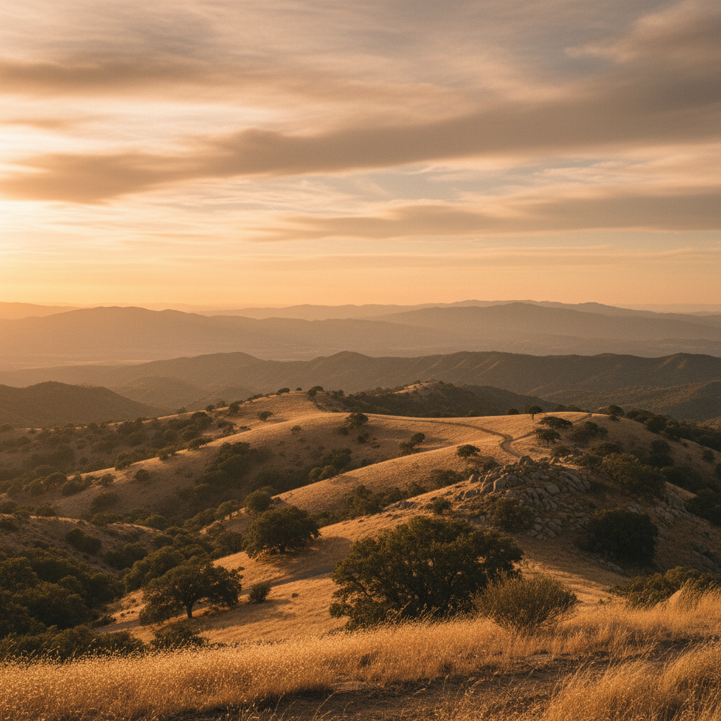
Cuyamaca Peak rises to an elevation of 6,512 feet, standing as the second-highest summit in San Diego County and a prominent landmark of the Peninsular Ranges. The journey to the top begins at the Paso Picacho Campground, situated at 5,000 feet, where hikers set out on Lookout Road. This paved fire road winds up the mountain's southern flank, gaining roughly 1,500 feet of elevation over a 1.75-mile climb. While the pavement makes navigation straightforward, the grade is consistently steep, offering a rigorous workout under an open sky. The air grows noticeably cooler and thinner with every switchback, carrying the scent of sun-baked granite, wild sage, and recovering mountain forest.
The ecology of the peak is a profound study in natural resilience, shaped by the devastating 2003 Cedar Fire. Before the fire, a dense canopy of white fir, incense cedar, and sugar pine shaded these upper slopes. Today, the landscape is defined by silvered, skeletal trunks of ghost pines that stand as monuments to the past, while a vibrant understory of fire-following chaparral reclaims the mountain. Thick stands of manzanita with smooth red bark, ceanothus, and scrub oak crowd the hillsides, while young black oaks push upward to re-establish the canopy. This moisture-rich mountain has always been a sanctuary: the Kumeyaay people call this highland region 'Ekwiiyemak, meaning "behind the clouds" or "the place where it rains," a reference to how these high ridges capture Pacific moisture that fails to reach the desert below.
Reaching the summit reveals a landscape that feels like an island in the sky, where a jumble of granitic boulders sits alongside a cluster of communication antennas. The true reward is the panoramic view, a 360-degree sweep that places the geography of Southern California into sharp focus. On a clear day, the gaze travels west across the coastal plains to the Pacific Ocean, where the Coronado Islands float on the horizon, and north toward the peaks of the San Jacinto and San Bernardino ranges. To the east, the mountain drops away dramatically into the shimmering, sun-baked expanse of the Anza-Borrego Desert. In the winter months, Pacific storms frequently coat this high-altitude world in a layer of snow, transforming the chaparral and stone into a quiet, alpine environment that feels entirely removed from the coastal cities below.
Park at the Paso Picacho Campground day-use lot for a vehicle fee, where you can find restrooms and trail maps. Because the 6,512-foot summit is highly exposed, temperatures can be significantly colder and windier than at the trailhead, making a windbreaker and an extra layer essential even on warm days.