A high-desert oasis in eastern Nevada featuring a 65-acre reservoir, sheer volcanic cliffs, and quiet canyons.
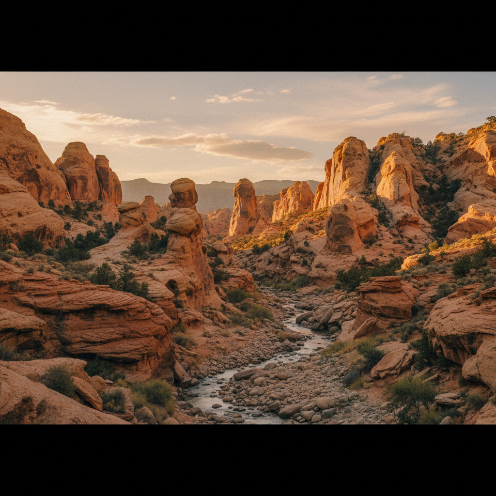
Echo Canyon State Park, situated 12 miles east of the historic mining town of Pioche in Lincoln County, Nevada, centers around a 65-acre reservoir that provides a stark, deep-blue contrast to the surrounding high-desert landscape. Resting at an elevation ranging from 5,200 to 5,600 feet, the park is defined by steep, sheer canyon walls of pink and gray ignimbrite tuff, which is ancient volcanic ash that consolidated and eroded over millions of years. This canyon was seasonally inhabited between 900 and 1100 C.E. by the Fremont people, who left behind stone flakes, pictographs, and thin-walled grayware, including Snake Valley pottery discovered near the park's steel bridge. Mormon pioneers arrived in the 1860s to establish trade routes, followed by permanent ranchers and farmers who settled the adjacent Dry Valley in the late 1870s. Today, the park serves as a critical riparian oasis in an arid country, where the waters of Meadow Valley Wash are captured to sustain both native wildlife and human recreation.
The park’s central feature, the Echo Canyon Reservoir, was created between 1969 and 1970 when Lincoln County constructed the Echo Canyon Dam for flood control and water storage. This 65-acre impoundment has since become one of southeastern Nevada’s premier fishing holes, regularly stocked with rainbow trout by the Nevada Division of Wildlife, while also supporting resident populations of largemouth bass, crappie, and occasional German brown trout. Waterfowl such as mallards, teals, herons, and trumpeter swans frequent the shoreline, while birds of prey like eagles, hawks, and owls ride the thermals rising from the canyon walls. On land, the riparian habitat of cottonwoods, cattails, and willows supports mule deer, coyotes, cottontails, and the occasional bobcat.
For overnight visitors, the park features two distinct camping areas. The North Campground offers 33 campsites equipped with shade gazebos, grills, and fire pits, with access to flush restrooms and fresh drinking water. Perched on a hill overlooking Dry Valley, the South Campground provides 20 full-hookup RV sites, complete with a dump station. Hikers can explore the volcanic geology of the area via the 2.5-mile Ash Canyon Trail, a loop that begins at the North Campground, winds through narrow passages of volcanic rock, and climbs to the valley rim for views of the reservoir. Alternatively, the Overlook Trail offers a shorter but steeper climb. Anglers and paddlers can launch motorized boats, kayaks, or paddleboards from the paved boat ramp on the reservoir's western shore, though low water levels occasionally require hand-launching directly from the bank. In October, the park becomes a key segment of the annual Park to Park Pedal Extreme, a long-distance road cycling event that connects three of Lincoln County's state parks.
Bring a kayak or paddleboard to explore the quiet coves of the reservoir, but check water levels beforehand as the boat ramp can close when levels are low. For hikers, the 2.5-mile Ash Canyon Trail loop is best tackled in the early morning to catch the soft light on the pink ignimbrite tuff.