A dramatic Big Sur landscape of deep redwood canyons, high ridges, and the historic ruins of cliffside estates overlooking the Pacific.
Julia Pfeiffer Burns State Park encompasses 3,762 acres of rugged Santa Lucia coastal slopes, deep redwood canyons, and high-elevation ridges. The park is named after Julia Pfeiffer Burns, a legendary local pioneer and rancher who spent her life working this demanding terrain. Her friend, Helen Hooper Brown, an heiress to the Hooper family fortune, purchased the land in 1924 with her husband, former New York Congressman Lathrop Brown. In 1961, Helen Hooper Brown donated the entire Saddle Rock Ranch to the state of California, requesting that the park honor her friend's memory. The dramatic landscape is defined by the steep Santa Lucia Range dropping straight into the Pacific Ocean, where old-growth redwoods, some reaching 300 feet tall and over 2,500 years old, thrive in the fog-drenched canyons while coastal scrub and chaparral cover the sun-baked ridges above.
The history of the park is physically preserved in the stone and metal remnants scattered across its terrain. Perched on the cliffs overlooking McWay Cove are the stone foundations, terraces, and imported palm trees of the Waterfall House, a modern residence built by the Browns in 1940. The couple decorated the home with original artwork by Edgar Degas, Raoul Dufy, and Paul Gauguin, but abandoned the property in 1956. When the state failed to convert the house into a museum within five years of the donation, the mansion was demolished in 1966 to comply with the deed's strict terms. High on the ridge, nearly 2,000 feet above the surf, sits the Tin House, a structure built by the Browns in 1944 to escape the coastal fog. Due to wartime material shortages, they constructed the house from two disassembled gas station buildings. Local lore claims the Browns spent only one night in the home, driven away by the loud popping sounds of the metal expanding and contracting in the mountain heat. Although the structure was severely damaged in the 2008 Basin Complex Fire, the ruins remain a popular destination for hikers climbing the steep Tanbark Trail.
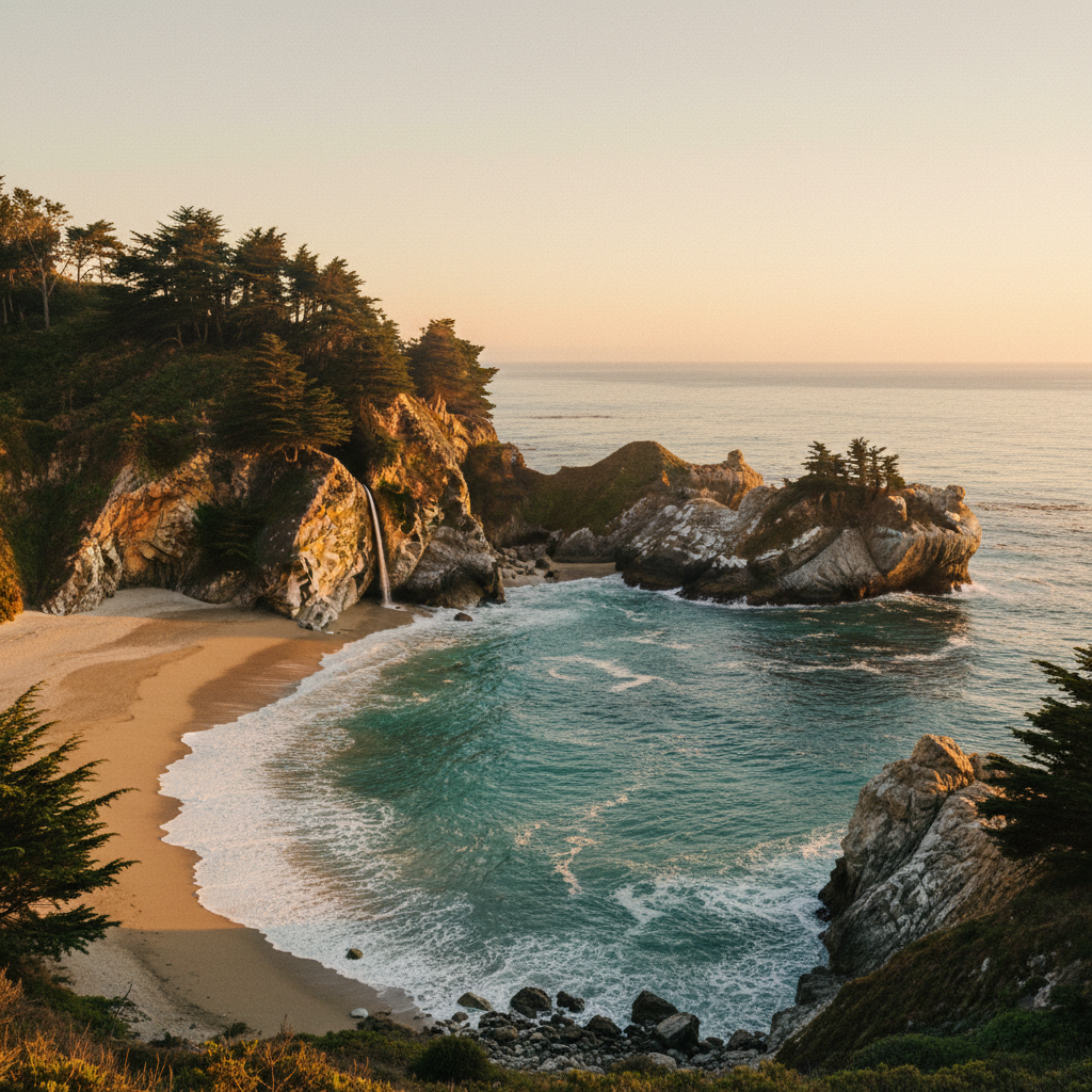
Recent conservation and maintenance projects have altered how visitors experience the park's most famous features. The iconic Waterfall Overlook Trail, which normally provides an easy walk to view the 80-foot McWay Falls cascading onto the sandy beach below, is closed for a long-term retaining wall repair project. Because of this closure, the waterfall can currently only be viewed from a designated roadside pullout along Highway 1. However, other historic areas of the park remain accessible. The Partington Cove Trail leads hikers down a steep dirt wagon road, across a wooden bridge over Partington Creek, and through a 60-foot tunnel blasted directly through the rock. Emerging from the tunnel reveals a rocky beach and the historic loading dock once used to ship redwood timber and tanbark oak in the late 19th century. For those seeking a rigorous climb, the Tanbark Trail winds through dense stands of tanbark oaks and redwood groves, offering a cool, shaded environment that contrasts sharply with the exposed coastal cliffs.
Because the McWay Falls Overlook Trail is currently closed for long-term repairs, avoid searching for trail access inside the park to view the falls: pull off at the designated roadside viewing area on Highway 1 instead. For an uncrowded hike, explore Partington Cove early in the morning when the marine fog still clings to the historic wooden bridge and rock tunnel.