Montana's largest state park protects a rugged maze of badlands, ancient pine groves, and rich Cretaceous fossil beds just outside Glendive.
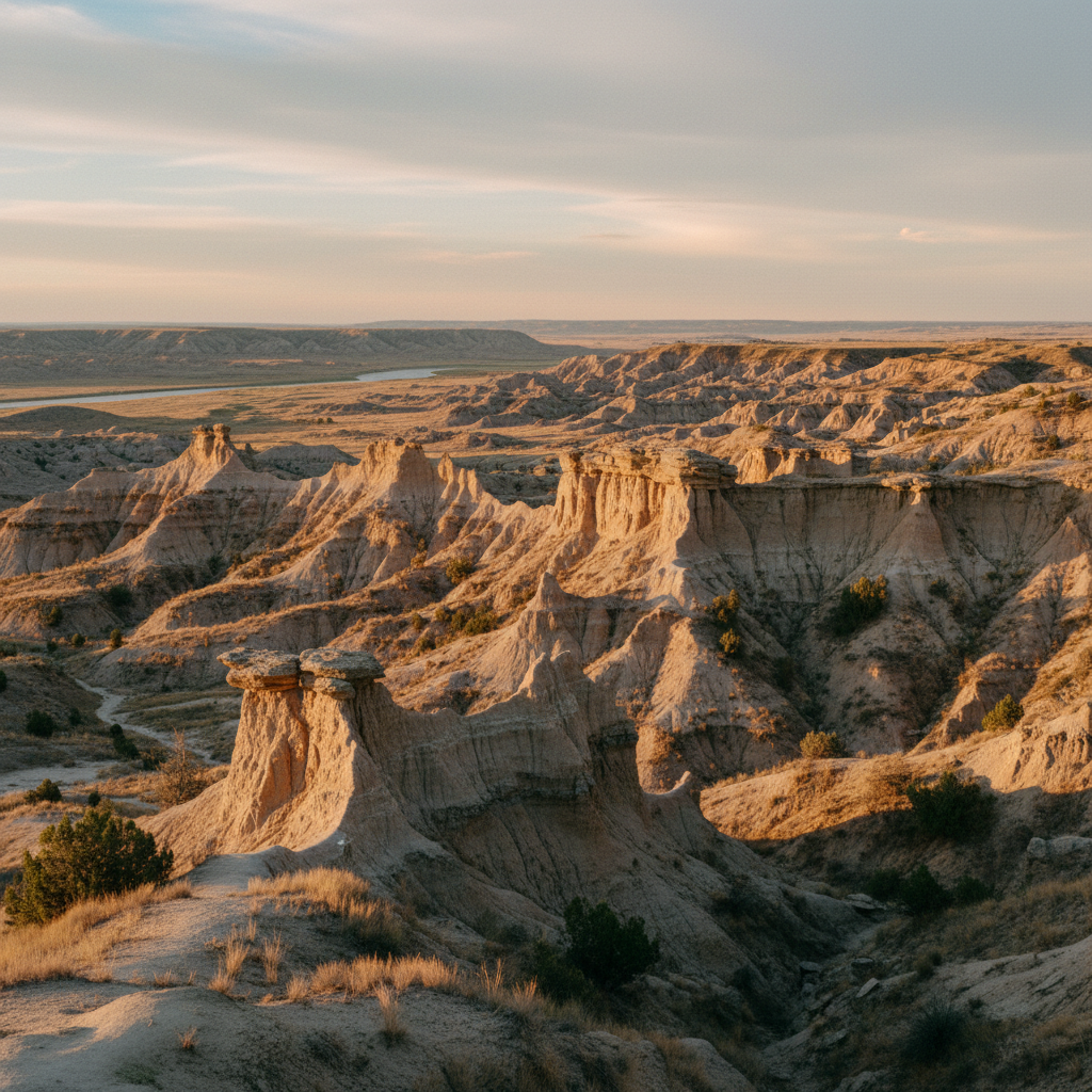
Makoshika State Park, Montana's largest state park, encompasses 11,538 acres of deeply eroded badlands situated just southeast of Glendive along the Yellowstone River. The park's name derives from the Lakota phrase *mako sica*, translating to 'bad land' or 'bad earth,' a fitting descriptor for a terrain defined by stark caprocks, towering hoodoos, and natural stone bridges. Historically, these rugged canyons and hidden coulees were inhabited and traversed by several Indigenous nations, including the Lakota, Dakota, Cheyenne, Crow, Assiniboine, Mandan, and Hidatsa, who maintained oral histories of the prehistoric remains found here. Today, the landscape presents a dramatic geological transition from the surrounding eastern Montana prairie, characterized by a striking contrast of gray and brown shale, pale sandstone, and hardy ponderosa pines clinging to the dry slopes.
The geological story of the park is written in the layers of the Hell Creek Formation, a globally renowned geologic unit that preserves the final years of the Cretaceous Period. Over ten different dinosaur species have been discovered within these badland boundaries, including *Tyrannosaurus rex*, *Edmontosaurus*, and a nearly complete skeleton of the rare, herbivorous *Thescelosaurus*. In some areas of the park, visitors can spot the K-Pg (formerly K-T) boundary line, a distinct dark layer of clay rich in iridium and shocked quartz that marks the global mass extinction event from 66 million years ago. A pivotal moment in the park's modern history occurred during a 1990 expedition when paleontologist Diane Gabriel unearthed a complete, massive *Triceratops horridus* skull. This discovery served as the primary catalyst for building the park's modern visitor center, which now houses the skull, a paleontology prep lab, and extensive interpretive exhibits detailing 74 million years of regional history.
Recreational opportunities within the park allow visitors to engage directly with this ancient landscape. Hikers can choose from 11 designated trails, including the popular Caprock Trail, which loops past fragile geological formations, and the Diane Gabriel Trail, where a fossilized dinosaur rib remains visible in the rock face. Along the park's trails sits the historic McCarty Cabin, the original homestead of Catherine McCarty, who first proposed the badlands as a park in 1939 and donated her land to secure its preservation. For those staying overnight, the park features 28 campsites, including a reservable tipi at campsite 15, providing an immersive way to experience the dark skies at scenic viewpoints like Sand Creek Overlook and Artist Vista. The park also features an archery range, an 18-hole disc golf course, and hosts the annual Buzzard Day festival each June, making it a vibrant community hub as well as a sanctuary of deep time.
Stop by the visitor center to see the authentic Triceratops skull before hiking the Diane Gabriel Trail, where you can spot a fossilized dinosaur bone still embedded in the sandstone. If camping, reserve site 15 to spend the night in a traditional tipi under some of the state's darkest skies.