The rugged North Dakota badlands where a future president forged his conservation legacy among roaming bison, wild horses, and sculpted clay canyons.
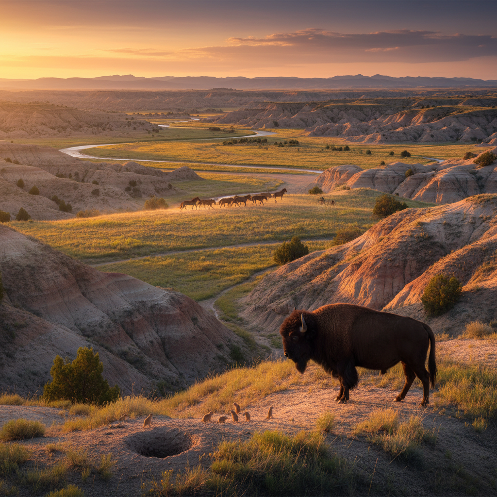
Theodore Roosevelt National Park covers more than 70,000 acres across western North Dakota, safeguarding a rugged badlands landscape of sculpted clay, petrified wood, and native prairie. Long before it was named for the twenty-sixth president, these badlands were traditional hunting and eagle-trapping grounds for the Mandan, Hidatsa, and Arikara (MHA Nation), as well as the Lakota, who historically referred to the Little Missouri River as Heȟáka Wakpá, meaning Elk River. Originally established as a Memorial Park in 1947 to honor Roosevelt’s conservation legacy, the area officially gained full national park status on November 10, 1978, under President Jimmy Carter, who also designated nearly 30,000 acres of the park as wilderness. Today, it remains the only American national park named directly for a single individual, preserving the exact terrain that transformed a young New York politician into an ardent conservationist.
The park is divided into three geographically separate units, each offering a distinct window into the region’s history and geology. The South Unit, accessed directly from the historic gateway town of Medora, features the Maltese Cross Cabin, where Roosevelt lived during his first trip to the Dakota Territory in 1883. Built from ponderosa pine, the cabin has been relocated to the South Unit Visitor Center and contains several of Roosevelt's personal belongings, including a writing desk and a wicker trunk emblazoned with his initials. Roughly 35 miles north along the Little Missouri River lies the remote and undeveloped Elkhorn Ranch Unit, the site of Roosevelt’s "home ranch" where he sought solace and rebuilt his life after his wife and mother died on the same day in 1884. While only the foundation stones of the ranch house remain, the site preserves the profound silence and isolation that inspired Roosevelt's early conservation philosophy.
The North Unit, situated about 80 miles north of Medora near Watford City, operates on Central Time, whereas the South Unit operates on Mountain Time. This northern section offers a more rugged, less-visited experience, characterized by deeper canyons and dramatic geological formations like the massive, spherical Cannonball Concretions. Scenic drives lead to iconic vistas such as the River Bend Overlook and Oxbow Overlook, while backcountry trails like the Caprock Coulee and Achenbach loop through steep clay coulees. Throughout all three units, the park protects vital Great Plains wildlife, including herds of plains bison, pronghorn, bighorn sheep, and expansive black-tailed prairie dog towns, alongside a historic herd of feral horses that continue to roam the South Unit's shortgrass prairies.
The park spans two time zones: the South Unit operates on Mountain Time, while the more rugged North Unit is on Central Time. For a quiet sunset, head to the River Bend Overlook in the North Unit.