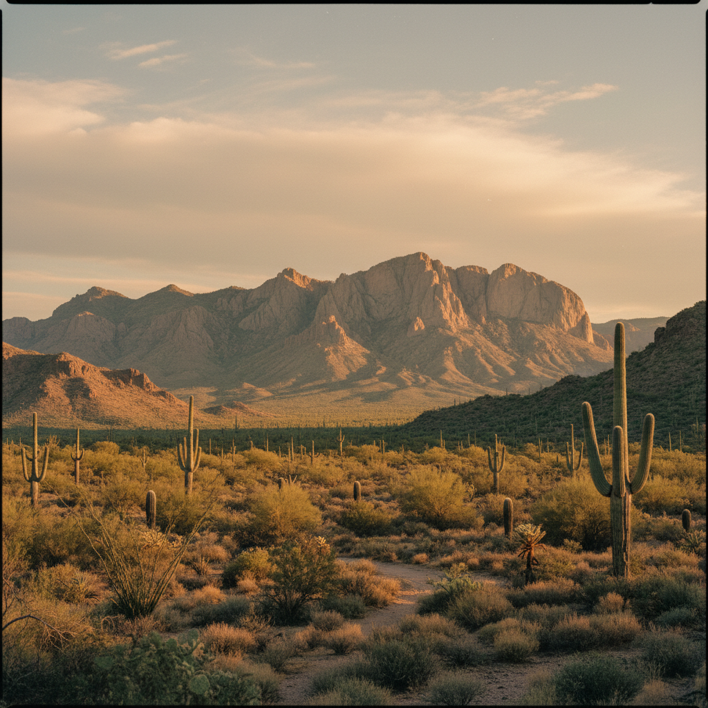
East of Phoenix, the volcanic spires and deep canyons of the Superstition Mountains rise sharply from the desert, steeped in Yavapai history and the enduring lore of lost gold.
The Superstition Mountains, known to the Yavapai as Wi:kchsawa and to the Akimel O'odham as Gakoḍk, rise sharply from the Sonoran Desert floor just east of Phoenix. This volcanic range, once called Sierra de la Espuma (Foam Mountain) by Spanish explorers, spans nearly 160,000 acres of protected wilderness within the Tonto National Forest. Formed between 15 and 30 million years ago during a period of intense Tertiary volcanic activity, the mountains are a labyrinth of jagged rhyolite cliffs, deep ash-flow tuff canyons, and towering hoodoos. The sheer western wall of the range dominates the horizon of Apache Junction, presenting a formidable barrier of dark stone that changes color from dusty ochre to deep purple as the desert sun shifts. According to O'odham tradition, the mountains were shaped by a great flood, while Apache lore holds them as a sacred domain inhabited by powerful spirits.
At the heart of the range lies its most famous geological landmark, Weaver's Needle, a 1,000-foot-tall volcanic spire of fused ash that peaks at 4,555 feet. Named after the 19th-century mountain man Pauline Weaver, the needle is central to the legend of the Lost Dutchman's Gold Mine. For generations, treasure hunters have searched the rugged canyons for the rich vein of gold supposedly discovered by German immigrant Jacob Waltz in the 1870s, guided by clues that claim the shadow of Weaver's Needle points to the hidden mine. Hikers seeking to view this iconic spire often follow the Peralta Trail, a moderately strenuous route that climbs through Peralta Canyon to Fremont Saddle. The trail winds past saguaros, ocotillos, and desert scrub, rewarding those who reach the saddle with a dramatic, head-on view of the needle rising abruptly from the canyon floor below.
For those seeking a physical challenge, the ascent to the Flatiron is the ultimate test of endurance within the western front of the range. Beginning in Lost Dutchman State Park, the Siphon Draw Trail leads hikers up a slickrock canyon before transitioning into a steep, unmaintained scramble up a rocky basin, gaining nearly 2,800 feet of elevation in just three miles. The summit of the Flatiron, a massive, anvil-shaped rock shelf, provides expansive views across the Salt River Valley and the distant Mazatzal Mountains. Alternatively, the Hieroglyphic Trail offers a gentler journey into the southern foothills, leading to a seasonal waterfall and a basalt cliffside etched with ancient Hohokam petroglyphs. Regardless of the chosen path, the Superstitions demand preparation, requiring sturdy footwear, careful navigation, and a significant supply of water to counter the dry, unforgiving desert heat.
Arrive at the Peralta or Siphon Draw trailheads before 7:00 AM, especially on weekends, as parking lots fill up early. Always carry at least three liters of water per person, and download offline maps, as cell service quickly vanishes once you descend into the volcanic canyons.