Ascend to New Mexico's highest point, a rugged alpine wilderness of ancient bristlecone pines, glacial cirques, and expansive Rocky Mountain vistas.
Wheeler Peak Wilderness encompasses 19,661 acres of the high Sangre de Cristo Mountains in northern New Mexico, a rugged alpine landscape dominated by the state's highest point. Rising to 13,161 feet, Wheeler Peak was originally known as Taos Peak before being renamed in 1950 to honor Major George Montague Wheeler, a nineteenth-century surveyor who led extensive geographic expeditions across the American Southwest. The wilderness area was officially designated by Congress in 1964 and is managed by the Carson National Forest. Geologically, the range was shaped by a massive tectonic uplift approximately 135 million years ago, revealing ancient Precambrian basement rocks like quartzite and granite that date back nearly 1.8 billion years. This high-altitude domain is bordered on the south by the sovereign lands of Taos Pueblo, whose people hold these peaks and the nearby, strictly restricted Blue Lake as sacred ground.
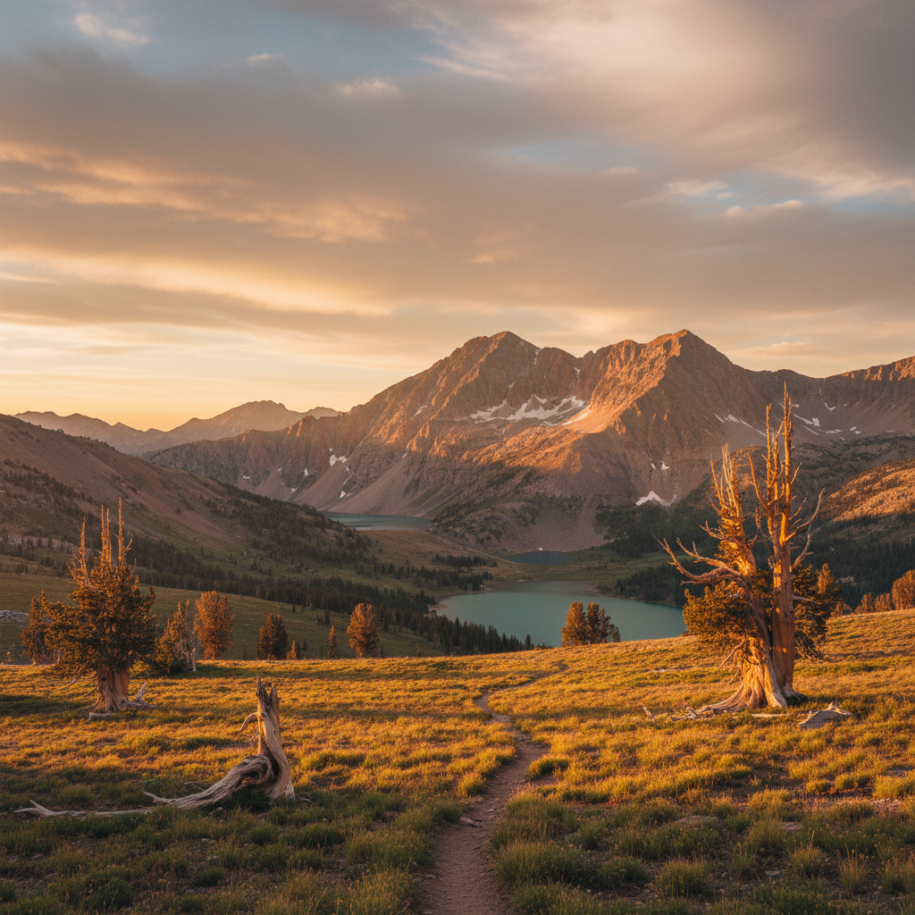
The wilderness area protects a rare island of alpine tundra in the American Southwest, a fragile ecosystem that begins where the subalpine forests of Engelmann spruce, subalpine fir, and quaking aspen give way to the elements. High on the windswept ridges, ancient bristlecone pines, some verified by researchers to be over 1,500 years old, twist into gnarled shapes to survive the harsh winters. This high-altitude habitat is home to a robust population of Rocky Mountain bighorn sheep, which can often be seen grazing on the grassy ridges near the summit. Below the tree line, yellow-bellied marmots whistle from talus slopes, pikas gather grass among the scree, and golden eagles ride the thermal updrafts. In the brief summer months, the tundra erupts in a carpet of tiny, resilient wildflowers, including alpine avens and forget-me-nots, while autumn transforms the lower canyons into a brilliant display of golden aspens.
Hikers generally access the summit via two primary routes starting from the Taos Ski Valley. The Williams Lake Trail (Trail 62) is the most direct option, leading past a glacier-carved alpine lake cradled in a dramatic rock cirque before tackling a steep, switchback-heavy climb over loose quartzite scree to the summit ridge. For a longer and more gradual journey, the Bull-of-the-Woods Trail (Trail 90) winds for roughly seven miles along the high ridges, passing Bull-of-the-Woods Pasture, Fraser Mountain, and the scenic La Cal Basin before reaching the peak. Along the final approach, hikers cross Mount Walter, which at 13,141 feet is the second-highest named point in New Mexico, though it lacks the prominence to be classified as an independent peak. From the true summit of Wheeler Peak, the reward is a vast panorama that stretches across the Moreno Valley, the deep rift of the Rio Grande, and the distant plains of the east.
To summit Wheeler Peak safely, an alpine start is essential to avoid violent afternoon thunderstorms. Begin hiking the Williams Lake Trail from the Taos Ski Valley well before sunrise, aiming to be off the exposed, treeless summit ridge and heading back down by noon. Be sure to pack windproof layers, as temperatures at the 13,161-foot summit can be freezing even in midsummer.