Explore a stark volcanic landscape of ancient lava flows, wild lava tubes, and towering sandstone cliffs steeped in Puebloan history.
El Malpais National Monument preserves a vast, primeval expanse of volcanic basalt and towering sandstone cliffs in western New Mexico. This rugged landscape is dominated by volcanic features produced during eruptions from the Zuni-Bandera volcanic field, which sits on the ancient Jemez Lineament. The McCartys flow, the most recent eruption in the region, occurred roughly 3,000 years ago, leaving behind a dark, glassy shield of basalt. Spanish explorers named the region "El Malpais," meaning "the bad country," due to the jagged, impassable terrain that proved impossible for horses and livestock to cross. During World War II, the federal government utilized the remote area as a bombing range for pilot training, and it was even considered as a potential test site for the Manhattan Project before White Sands was selected. On December 31, 1987, President Ronald Reagan signed the bill designating the 114,000-acre volcanic field as a national monument.
Despite the hostile, waterless appearance of the basalt, a highly specialized ecosystem thrives within the monument. Gnarled ponderosa pines, Rocky Mountain junipers, and Douglas firs wedge their roots deep into the cracks of the lava, drawing moisture from hidden ice deposits that persist underground. Researchers have discovered that El Malpais is home to some of the oldest living Douglas fir trees in North America, with some slow-growing specimens cross-dated to be over 1,200 years old. The treacherous lava fields have historically protected these ancient trees from wildfires, logging, and grazing. The monument is also one of the few places on earth where the rare cinder phacelia (Phacelia serrata) grows, a delicate purple wildflower that thrives only in volcanic cinders. For centuries, Indigenous peoples have successfully navigated and revered this terrain. The historic Zuni-Acoma Trail, a demanding 7.5-mile path marked by carefully stacked rock cairns, serves as a traditional trade and pilgrimage route connecting the nearby pueblos. To the Acoma, Zuni, Laguna, and Navajo people, these flows are not barren wastes but sacred ground, rich with oral histories and ancestral connections.
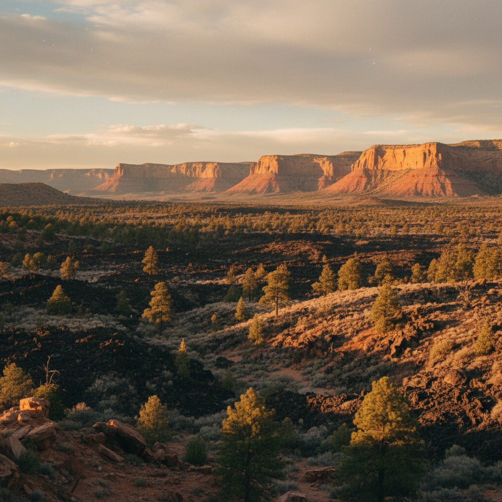
Exploring the monument requires preparation and a willingness to slow down. Visitors can hike the El Calderon Loop Trail to view the El Calderon cinder cone, the double sinks, and Junction Cave, or venture deep into the backcountry to the Big Tubes area. The park's extensive network of wild lava tubes was created when the outer layers of flowing lava cooled and hardened while molten rock continued to flow inside, leaving behind hollow, subterranean passages. Accessing these cold, dark caverns requires securing a free caving permit from the El Malpais Visitor Center, along with carrying proper safety gear like helmets, gloves, and multiple light sources. As afternoon fades, the Sandstone Bluffs Overlook provides an elevated vantage point along Highway 117. From here, the setting sun paints the sandstone cliffs in brilliant shades of gold and orange, casting long, dramatic shadows across the vast, dark expanse of the McCartys flow below.
For the most dramatic light, visit the Sandstone Bluffs Overlook along Highway 117 in the hour before sunset, when the low-angle light illuminates the golden cliffs against the black lava. If you plan to explore the lava tubes, remember to stop by the visitor center in Grants to obtain a free caving permit and complete a quick screening to protect local bat populations from white-nose syndrome.