Trace centuries of human history etched into a massive sandstone bluff, where a permanent desert pool drew Ancestral Puebloans, Spanish conquistadors, and American pioneers.
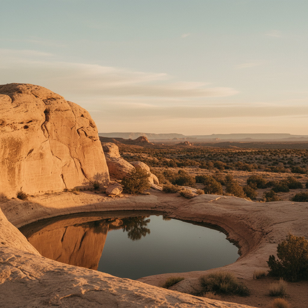
El Morro National Monument preserves a towering sandstone promontory that has served as a critical desert sanctuary for centuries of travelers. Rising 200 feet above the valley floor at an elevation of 7,219 feet, this massive Zuni Sandstone cuesta features a reliable, spring-fed pool at its base, making it a vital oasis along an ancient east-west trade route. The Zuni people call this place A'ts'ina, meaning 'place of writings on the rock,' while Spanish explorers dubbed it El Morro, or 'The Headland'. Long before modern roads mapped the American Southwest, the sheer, pale cliffs of this promontory acted as a stone guestbook, preserving the signatures, dates, and messages of those who stopped to rest and drink.
The earliest chroniclers were the Ancestral Puebloans, who established a thriving community atop the mesa between 1275 and 1350 CE. At its peak, up to 600 people lived in the 355-room Atsinna Pueblo, farming the surrounding valleys and utilizing the pool below. They left behind hundreds of petroglyphs, including distinct carvings of bighorn sheep and geometric patterns etched into the soft rock. Centuries later, Spanish explorers arrived, beginning with Antonio de Espejo in 1583. On April 16, 1605, New Mexico's first Spanish governor, Don Juan de Oñate, carved his name and the phrase 'pasó por aquí' (passed by here) into the rock face, a full 15 years before the Pilgrims landed at Plymouth Rock. As the territory transitioned to American control in the mid-19th century, U.S. Army officers, emigrant families, and railroad surveyors added their own precisely chiseled signatures to the wall, creating a continuous historical ledger.
Today, travelers can explore this history via two primary trails that begin at the visitor center. The half-mile Inscription Loop Trail is paved and fully accessible, guiding visitors directly to the shaded pool and the most prominent historic carvings. For a more challenging hike, the two-mile Headland Trail climbs 250 feet up the bluff. This loop trail ascends the steep sandstone face via carved stairs and switchbacks, leading to the top of the mesa where the silent, stone-walled ruins of Atsinna Pueblo command panoramic views of the Zuni Mountains and the dark, volcanic fields of El Malpais. Near the park entrance, a nine-site, fee-free campground offers primitive camping under a canopy of piñon and juniper trees, operating on a first-come, first-served basis.
Begin your visit at the visitor center to borrow a detailed trail guide, which helps decipher the faint Spanish script and petroglyphs along the paved Inscription Loop. If you plan to hike the steeper Headland Trail to the Atsinna ruins, wear sturdy boots for the slickrock sections and carry plenty of water, as the high-altitude sun at 7,219 feet can be intense.