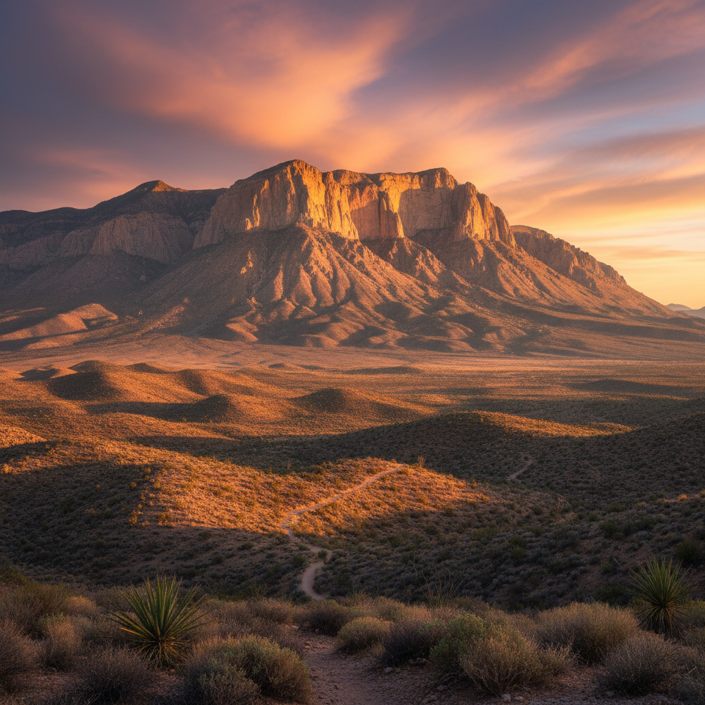
The highest peaks in Texas, carved from a 260-million-year-old fossil reef rising out of the Chihuahuan Desert.
Guadalupe Mountains National Park protects a massive, fossilized Permian-era reef that looms abruptly over the salt flats and creosote flats of the Chihuahuan Desert. This mountain range is the exposed cross-section of the Capitan Reef, a horseshoe-shaped limestone structure formed 260 million years ago when a tropical inland sea covered this portion of West Texas and southeastern New Mexico. Over eons, tectonic forces uplifted the reef and erosion stripped away the surrounding sediment, revealing a dramatic geological fortress. The most prominent feature of this range is El Capitan, a sheer, 8,078-foot limestone cliff that serves as an unmistakable beacon for travelers along the highway below. Unlike typical mountain ranges formed by volcanic activity or continental collisions, these peaks are a massive graveyard of ancient marine life, where fossilized sponges, algae, and brachiopods are preserved directly in the white stone.
Human history in these canyons spans over 10,000 years, beginning with hunter-gatherers who left behind projectile points, basketry, and rock art in limestone caves. This rugged terrain later became the ancestral homeland and final stronghold of the Mescalero Apache, or Nde, who adapted to the arid climate by harvesting native agave, or mescal, in stone roasting pits that are still visible today. By the late 19th century, conflict with the US Cavalry and Buffalo Soldiers forced the Apache from the mountains, paving the way for homesteaders and ranchers. The historic Frijole Ranch, established in the 1870s, preserves a springhouse, schoolhouse, and a small orchard cultivated by the Smith family near the base of Frijole Ridge. Further west, the remote Williams Ranch house stands in the shadow of the western escarpment, accessible only by a rugged four-wheel-drive road. The park's creation was largely catalyzed by Wallace Pratt, a pioneering petroleum geologist who bought land in McKittrick Canyon in 1921, built a stone cabin along the canyon floor, and eventually donated 5,632 acres to the federal government in 1961.
With over 80 miles of trails, the park is a premier destination for wilderness hiking and desert exploration. The most famous route is the strenuous Guadalupe Peak Trail, which climbs 3,000 vertical feet over 8.4 miles round-trip to reach the highest point in Texas at 8,751 feet above sea level. At the summit, hikers are greeted by a stainless steel pyramid erected by American Airlines in 1958 and sweeping views of the Salt Basin Dunes to the west. In sharp contrast to the arid peaks, McKittrick Canyon serves as a riparian oasis, protecting a fragile stream and a pocket of high-elevation forest. In late October and early November, the canyon's bigtooth maples, chinquapin oaks, and Texas madrones burst into a brilliant display of red, orange, and yellow foliage. Other notable trails include the moderate 2.3-mile loop to Smith Spring, where mule deer and phainopeplas gather near the shaded water, and the quiet path to the ruins of the Pinery Station, a mid-1800s stagecoach stop along the historic Butterfield Overland Mail route.
To witness the park's famous autumn colors, visit McKittrick Canyon in late October or early November when the bigtooth maples turn brilliant shades of red and gold. If you plan to hike Guadalupe Peak, start before 7:30 AM to secure a parking spot at the Pine Springs trailhead and avoid the intense midday desert heat.