A classic 7.2-mile alpine loop in the North Cascades featuring golden larches, glacial lakes, and granite ridges.
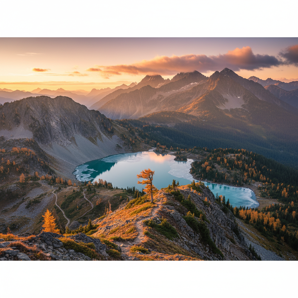
The Heather-Maple Pass Loop Trail #740 offers one of the most immediate entries into the high alpine country of the North Cascades. Located on the ancestral lands of the sp̓aƛ̓mul̓əxʷəxʷ (Methow) people, this 7.2-mile loop begins and ends at the Rainy Pass trailhead along State Route 20, sitting at an elevation of 5,476 feet. Because the trail is managed by the Okanogan-Wenatchee National Forest rather than the adjacent national park, it serves as a rare, dog-friendly corridor that skirts the very edge of the park boundary. The trail climbs steadily through dense stands of mountain hemlock and subalpine fir, gaining roughly 2,200 feet of elevation as it ascends toward its 6,650-foot high point at Maple Pass. Along the way, the forest thins to reveal Lake Ann, a deep blue body of water resting in a glacial cirque directly below the trail, and the massive granite towers of the Golden Horn batholith, including Liberty Bell Mountain and the Early Winters Spires, which dominate the eastern horizon.
The geology of the loop is a visible record of massive tectonic forces and glacial carving. The sharp, light-colored granite underfoot belongs to the Golden Horn batholith, a body of magma that cooled deep within the earth's crust before being uplifted and chiseled by Pleistocene glaciers. This rugged terrain supports a fragile subalpine ecosystem where heather meadows bloom with lupine, paintbrush, and valerian during the brief summer months. As autumn approaches, the trail becomes a focal point for the annual change of the western larch (Larix lyallii). Unlike most conifers, these deciduous pines shed their needles, turning a vibrant, glowing gold in late September and early October. This seasonal transformation draws thousands of hikers to the pass, a phenomenon locally known as larch madness, when the golden needles contrast sharply with the dark green hemlocks and the gray granite of Frisco Peak.
Hiking the loop in a counter-clockwise direction provides a more gradual ascent and keeps the most expansive vistas directly ahead during the descent. The trail climbs to a narrow, exposed ridgeline where the wind sweeps across from the west, carrying the scent of subalpine phlox and dry stone. From this high ridge, the 360-degree views stretch across the Stephen Mather Wilderness, revealing a sea of jagged, snow-dusted peaks and deep, u-shaped valleys. Because of the fragile nature of this high-altitude environment, strict regulations are in place: camping is prohibited within a quarter-mile of Lake Ann, Rainy Lake, and the loop trail itself, preserving the delicate meadows for the resident hoary marmots, pikas, and mountain goats. The descent completes the loop through cool, shaded switchbacks, crossing small glacial meltwater creeks before returning to the paved paths of the Rainy Pass picnic area.
To experience the views unfolding gradually, hike the loop counter-clockwise. A Northwest Forest Pass is required at the Rainy Pass trailhead, and because this trail is dog-friendly, expect heavy trail traffic on autumn weekends. Arrive before 7:30 AM during peak larch season in late September.