A primitive Montana state park where Belt Creek has carved a sheer limestone canyon lined with historic mining cabins and railroad ruins.
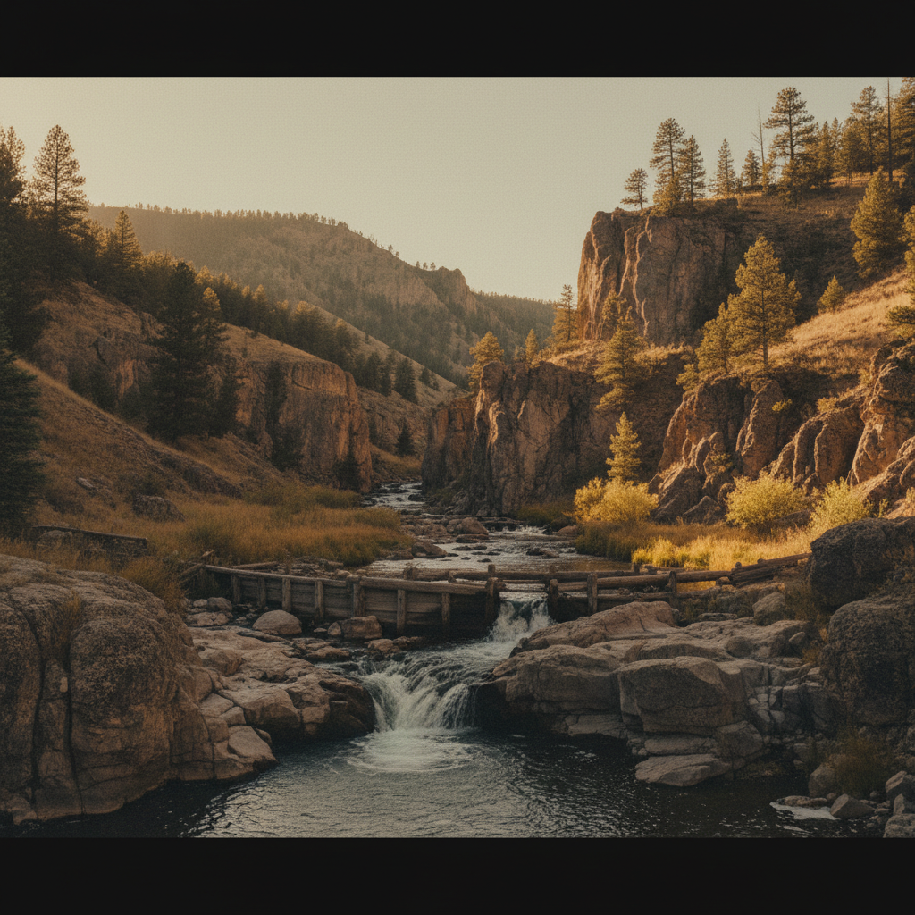
Sluice Boxes State Park occupies a rugged, eight-mile stretch of the Belt Creek Canyon, where the spring-fed waters of Belt Creek have carved a sheer, 500-foot gorge through the limestone of the Little Belt Mountains. Belt Creek, known traditionally as kɔyɔ́ɔteihíniicááh (meaning "Belt River") in the Gros Ventre language, serves as the centerpiece of this 1,454-acre park located south of Belt, Montana. The canyon walls, composed of ancient limestone layers that shift in color from cool grey to warm ochre, rise steeply above a thriving riparian zone filled with cottonwoods, willows, and ponderosa pines. Today, the park remains a primitive, unmaintained wilderness where the natural landscape is slowly reclaiming the skeletal remains of a bustling industrial past.
The canyon's human history is dominated by the remnants of the Montana Central Railway, a branch line built in 1891 to connect the silver, lead, and zinc mines of Monarch, Barker, and Neihart with the smelters in Great Falls. Engineers blasted tunnels and erected massive wooden trestles to navigate the narrow gorge, while the mid-canyon town of Albright thrived around limestone quarries and kilns that supplied fluxing limestone to the Anaconda Company's Great Falls smelter. In 1914, the Great Northern Railway began running Sunday "Fish Trains" to transport eager anglers from Great Falls directly to the canyon’s deep pools. The mining boom eventually faded, and the final train rolled through the canyon in 1945, leaving behind concrete abutments, iron scrap, a short hand-blasted tunnel, and decaying log cabins that slowly surrender to the elements.
Exploring the park today requires hiking the primitive, unmaintained Sluice Boxes Trail, which follows the old railroad bed and demands between five and fifteen creek crossings depending on the route. Because the train bridges are long gone, hikers must ford the cold, swift waters of Belt Creek, which can be waist-deep during the spring runoff. Consequently, the optimal season for through-hiking is from mid-July through September when water levels drop. Recent geological activity has added new challenges: a series of winter rockslides, triggered by earthquakes near Great Falls in early 2026, deposited massive boulders in the creek about a half-mile downstream of the Logging Creek Bridge and obstructed a 100-foot section of the trail, requiring hikers to scramble over raw rock.
Plan your visit for late summer or early fall when Belt Creek’s water levels are typically lower, making the five to fifteen necessary creek crossings manageable. Bring sturdy, closed-toe water shoes with excellent traction to navigate the slippery rocks, and prepare to scramble over the fresh rockslide debris located downstream of Logging Creek Bridge.